Colorado
| V・T・E |
| latitude: 39.028, longitude: -105.546 |
| Browse map of Colorado 39°01′40.80″ N, 105°32′45.60″ W |
| Edit map |
|
External links:
|
| Use this template for your locality |
Colorado is a state in the United States at latitude 39°01′40.80″ North, longitude 105°32′45.60″ West.
Community
- Events
- The OSM community in Colorado uses Meetup.com to organize and announce events, visit OSM-Colorado for details and/or to join.
- Regional MeetUps include:
- Mailing list
- There is a mailing list for discussing US-specific issues. It is a great best place to find other US mappers.
- Slack
- There is a #colorado channel on OSM-US Slack.
Disaster mapping
2013 Colorado Incidents: 2013 Colorado Floods and 2013 Colorado Wildfire Season
Highway Classification
Draft guidance for highway classification is underway at Colorado/Highway Classification.
Rail
Try Colorado/Railroads.
Cities
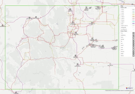
Power network
Imagery
Bing has high resolution imagery of the Denver area but it is at least 5 years old so beware.
USGS
This is the capabilities URL for USGS in Colorado. It has layers listed for Colorado Springs, Denver and Fort Collins:
http://imsortho.cr.usgs.gov/wmsconnector/com.esri.wms.Esrimap/USGS_EDC_Ortho_Colorado?REQUEST=capabilities&SERVICE=WMS
The most recent USGS imagery for Denver is 0.6m and captured in 2008. It is split into two strips. Most of the city is covered by the western strip.
- Eastern Denver: http://imsortho.cr.usgs.gov:80/wmsconnector/com.esri.wms.Esrimap/USGS_EDC_Ortho_Colorado?FORMAT=image/jpeg&VERSION=1.1.1&SERVICE=WMS&REQUEST=GetMap&Layers=DenverCO_0.6m_Color_Mar_2008_01&
- Western Denver: http://imsortho.cr.usgs.gov:80/wmsconnector/com.esri.wms.Esrimap/USGS_EDC_Ortho_Colorado?FORMAT=image/jpeg&VERSION=1.1.1&SERVICE=WMS&REQUEST=GetMap&Layers=DenverCO_0.6m_Color_Mar_2008_02&
Potential data sources
This section lists the entities, whether government, commercial, or otherwise, that have GIS related information that might be beneficial for inclusion to OSM. Each entry can be expounded upon as to data worthiness (i.e. crime statistics vs. usable shapefiles, vs. etc.), potential licensing issues, and other useful information.
State of Colorado
- http://www.oit.state.co.us/
- http://www.oit.state.co.us/strategy/gis
- OpenColorado
- Colorado GeoData Cache
- RTD Regional Transportation District
- https://data.colorado.gov
- http://data.opencolorado.org/
County of Adams
- http://www.co.adams.co.us/index.aspx?nid=417
- City of Arvada (license terms unclear, see here)
- City of Aurora
- City of Brighton
- City of Commerce City
- City of Federal Heights
- City of Thorton
- City of Westminster (references opencolorado.org)
County of Arapahoe
County of Archuleta
County of Boulder
- http://www.bouldercounty.org/gov/data/pages/gisdldata.aspx (data licensed as CC0)
- City of Boulder (data licensed as CC0)
- City of Longmont
City and County of Broomfield
County of Clear Creek
County of Delta
City and County of Denver
The Denver Regional Council of Governments has offered to make available infrastructure data for the Denver region to the OSM community. More details about this are described in the Denver Planimetrics Import wiki page.
County of Douglas
County of Eagle
County of El Paso
- http://adm.elpasoco.com/InformationTechnologies/GeographicInformationSystems/Pages/default.aspx
- City of Colorado Springs
- Town of Monument
County of Garfield
County of Gilpin
County of Grand
County of Gunnison
County of Huerfano
County of Jefferson
- http://jeffco.us/services/online-services/maps-and-gis-products-catalog/
- City of Golden
- City of Lakewood
- City of Wheat Ridge
County of La Plata
County of Larimer
- http://www.co.larimer.co.us/gis/digital-data.cfm
- City of Fort Collins
- City of Loveland
- Town of Berthoud
- Town of Wellington
County of Las Animas
County of Mesa
- http://gis.mesacounty.us/ (for permissions, see https://emap.mesacounty.us/Blog/downloading-mesa-county-ortho-photography/)
- City of Grand Junction
County of Moffat
County of Montezuma
- [http://www.cityofcortez.com/index.aspx?nid=214 City of Cortez
County of Montrose
County of Morgan
County of Ouray
County of Park
County of Pitkin
County of Pueblo
County of Rio Blanco
County of Routt
County of San Juan
County of San Miguel
County of Summit
- http://www.co.summit.co.us/index.aspx?nid=251 (requires license?)
County of Weld
- http://www.co.weld.co.us/Departments/GIS/GISData.html (requires license?)
- City of Greeley
- Town of Windsor

