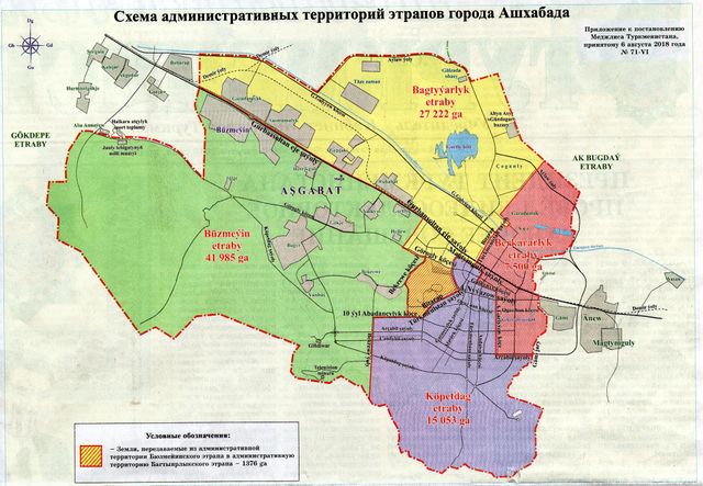
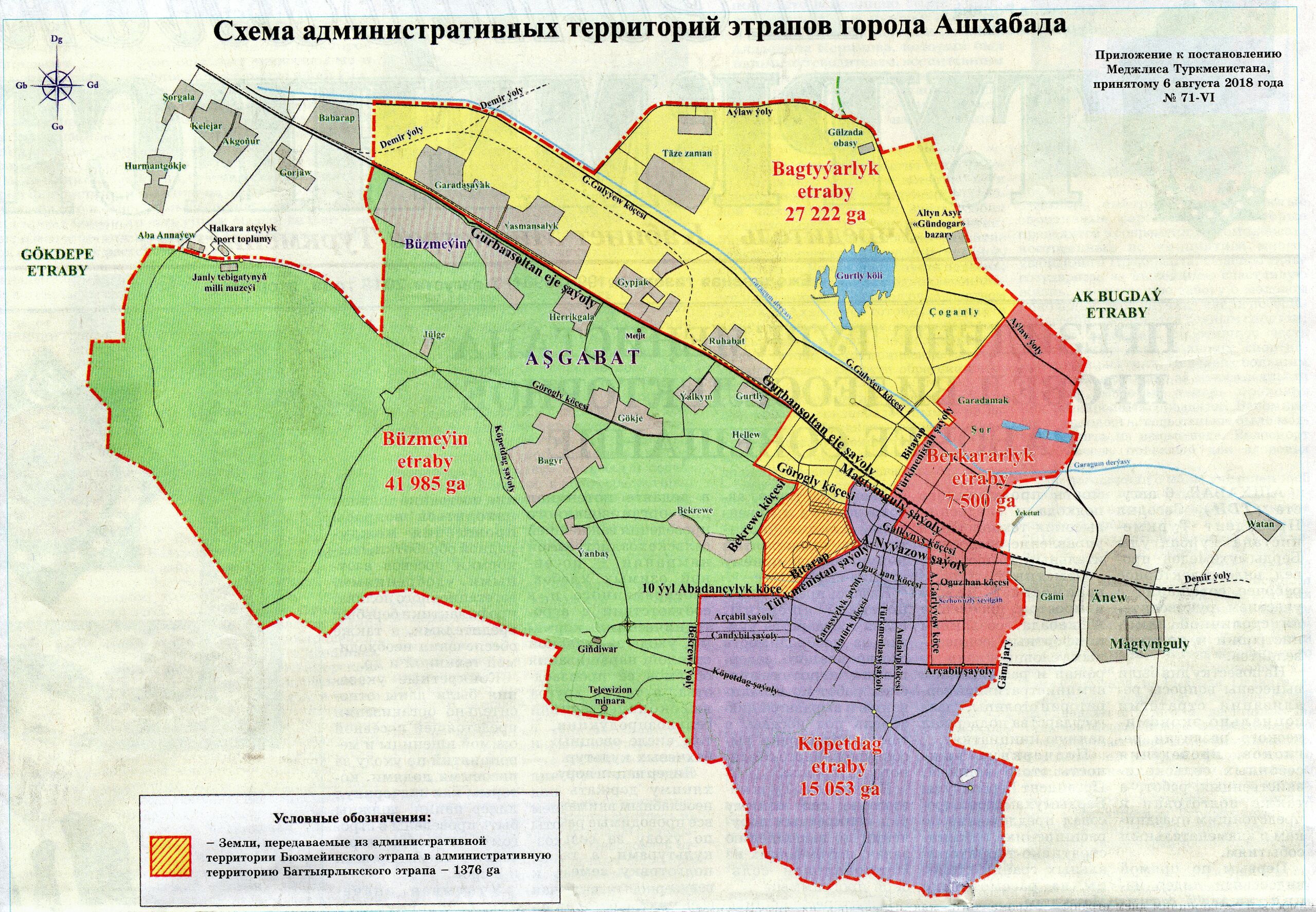
File:180806 Ashgabat etrap boundaries.jpg

Original file (3,850 × 2,667 pixels, file size: 3.36 MB, MIME type: image/jpeg)
Summary
| Description | Official boundaries of the city of Ashgabat and its four boroughs as of 6 August 2018, as published in the official daily newspaper "Neytral'nyy Turkmenistan" on page 2 |
|---|---|
| Author | Neytral'nyy Turkmenistan |
| Source | "Neytral'nyy Turkmenistan", 6 August 2018, on page 2 |
| Date | 2018 |
Licensing
This document is in the public domain.
Under Turkmenistan's copyright law,
Article 7. Works that are not objects of copyright
Not subject to copyright:
- official documents (laws, court decisions, other texts of a legislative, administrative and judicial nature), as well as their official translations;
- state symbols and signs (flag, coat of arms, anthem, awards, banknotes and other state symbols and signs);
- folk art (expressions of folklore); - messages about events and facts of an informational nature.''
File history
Click on a date/time to view the file as it appeared at that time.
| Date/Time | Thumbnail | Dimensions | User | Comment | |
|---|---|---|---|---|---|
| current | 12:42, 7 August 2018 | | 3,850 × 2,667 (3.36 MB) | Apm-wa (talk | contribs) | Official boundaries of the city of Ashgabat and its four boroughs as of 6 August 2018, as published in the official daily newspaper "Neytral'nyy Turkmenistan" on page 2 |
You cannot overwrite this file.
File usage
The following file is a duplicate of this file (more details):
- File:2018 01 06 ashgabat etrapy separation 24784.jpg from Wikimedia Commons
The following page uses this file: