File:20240412 OSM sidewalk map-routing graphhopper.png
Jump to navigation
Jump to search


Size of this preview: 551 × 600 pixels. Other resolutions: 220 × 240 pixels | 441 × 480 pixels | 680 × 740 pixels.
Original file (680 × 740 pixels, file size: 925 KB, MIME type: image/png)
Summary
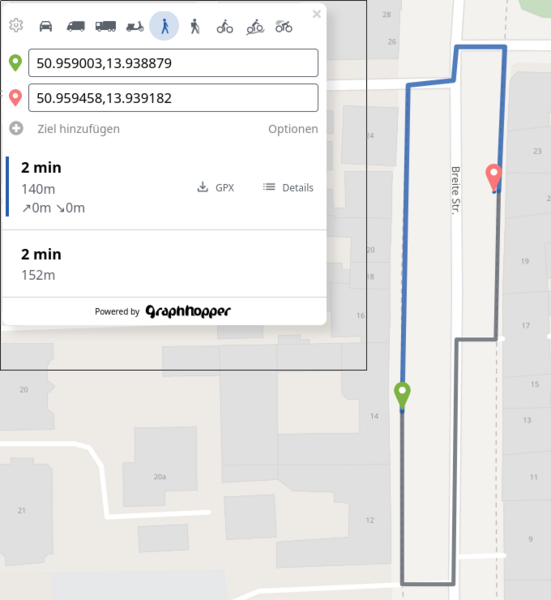
| Description | testing graphhopper maps & router on existing OSM data |
|---|---|
| Author | © OpenStreetMap contributors |
| Source | screenshot of GraphHopper Maps https://graphhopper.com/maps |
| Date | 2024-04-12 |
Licensing
![]()
![]()
This work is licensed under the Creative Commons Attribution 4.0 License.
Attribution: Omniscale, 2024, https://maps.omniscale.com/de/p/termsofuse
Attribution: Omniscale, 2024, https://maps.omniscale.com/de/p/termsofuse
| Contains map data © OpenStreetMap contributors, made available under the terms of the Open Database License (ODbL).
The ODbL does not require any particular license for maps produced from ODbL data, produced maps may be subject also to other licences. |
File history
Click on a date/time to view the file as it appeared at that time.
| Date/Time | Thumbnail | Dimensions | User | Comment | |
|---|---|---|---|---|---|
| current | 02:26, 1 May 2024 | | 680 × 740 (925 KB) | Hasienda (talk | contribs) | {{Information | description=testing graphhopper maps & router on existing OSM data | source=screenshot of ''GraphHopper Maps'' https://graphhopper.com/maps | date=2024-04-12 | author=© OpenStreetMap contributors | other_versions= }} |
You cannot overwrite this file.
File usage
The following page uses this file: