File:Ascot 20080920.png
Jump to navigation
Jump to search

Size of this preview: 800 × 448 pixels. Other resolutions: 320 × 179 pixels | 640 × 358 pixels | 984 × 551 pixels.
Original file (984 × 551 pixels, file size: 60 KB, MIME type: image/png)
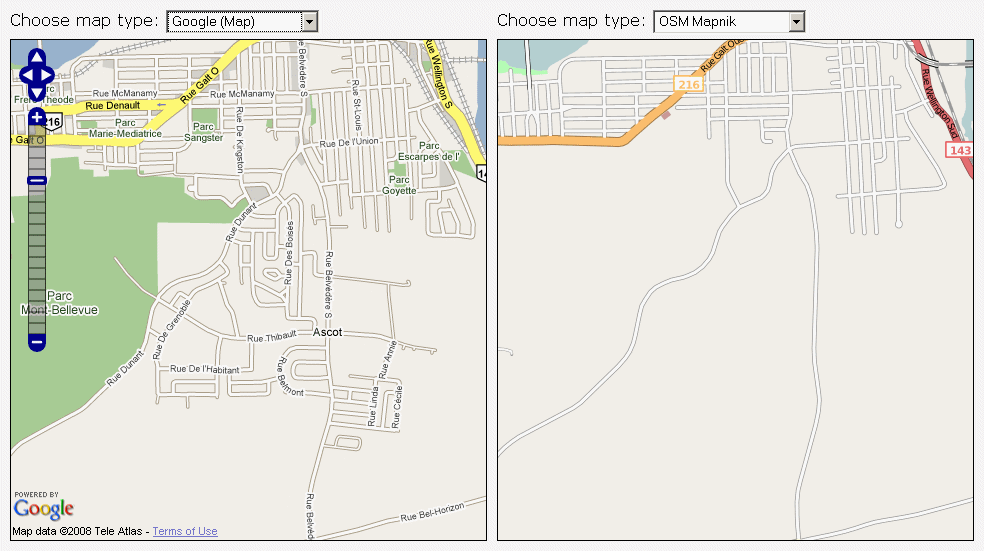
Area to be mapped at Sherbrooke Mapping party
Licensing
left: © Google Maps
right:
![]()
Contains map data © OpenStreetMap contributors, made available under the terms of the Creative Commons Attribution-ShareAlike 2.0 (CC-BY-SA-2.0).
![]()
It has been proposed that this page be deleted or replaced by a redirect. See the discussion page for further information.
The given reason is: we can keep Google Maps as fair use in some cases - but unused materials do not qualify as fair use so this should be deleted.
The given reason is: we can keep Google Maps as fair use in some cases - but unused materials do not qualify as fair use so this should be deleted.
File history
Click on a date/time to view the file as it appeared at that time.
| Date/Time | Thumbnail | Dimensions | User | Comment | |
|---|---|---|---|---|---|
| current | 15:04, 14 September 2008 | | 984 × 551 (60 KB) | Fsteggink (talk | contribs) | Area to be mapped at Sherbrooke Mapping party |
You cannot overwrite this file.
File usage
There are no pages that use this file.