File:Avantapres.png
Jump to navigation
Jump to search


Size of this preview: 800 × 565 pixels. Other resolutions: 320 × 226 pixels | 640 × 452 pixels.
Original file (850 × 600 pixels, file size: 295 KB, MIME type: image/png)
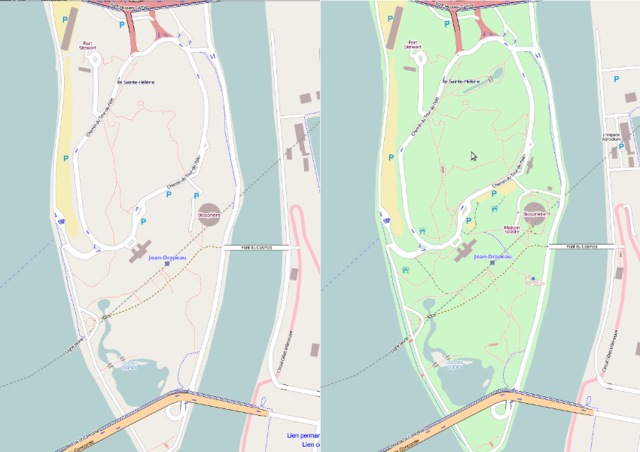
State of the map of Parc Jean-Drapeau before the 2010 October Montreal Mapping Party and a month later after most of the edits were integrated
Licensing
![]()
![]()
![]()
This screenshot contains OpenStreetMap Carto rendering.
The OpenStreetMap Carto map style is made available under the Creative Commons CC-0 1.0 Universal Public Domain Dedication.
- Attribution to the map data:
![]()
Contains map data © OpenStreetMap contributors, made available under the terms of the Creative Commons Attribution-ShareAlike 2.0 (CC-BY-SA-2.0).
File history
Click on a date/time to view the file as it appeared at that time.
| Date/Time | Thumbnail | Dimensions | User | Comment | |
|---|---|---|---|---|---|
| current | 02:30, 10 November 2010 | | 850 × 600 (295 KB) | Greenscientist (talk | contribs) | State of the map of Parc Jean-Drapeau before the 2010 October Montreal Mapping Party and a month later after most of the edits were integrated |
You cannot overwrite this file.
File usage
The following page uses this file: