File:CAPT Umap espaces-activites-eco 2019-05.JPG
Jump to navigation
Jump to search

Size of this preview: 800 × 450 pixels. Other resolutions: 320 × 180 pixels | 640 × 360 pixels | 1,024 × 576 pixels | 1,280 × 720 pixels | 1,920 × 1,080 pixels.
Original file (1,920 × 1,080 pixels, file size: 279 KB, MIME type: image/jpeg)
Summary
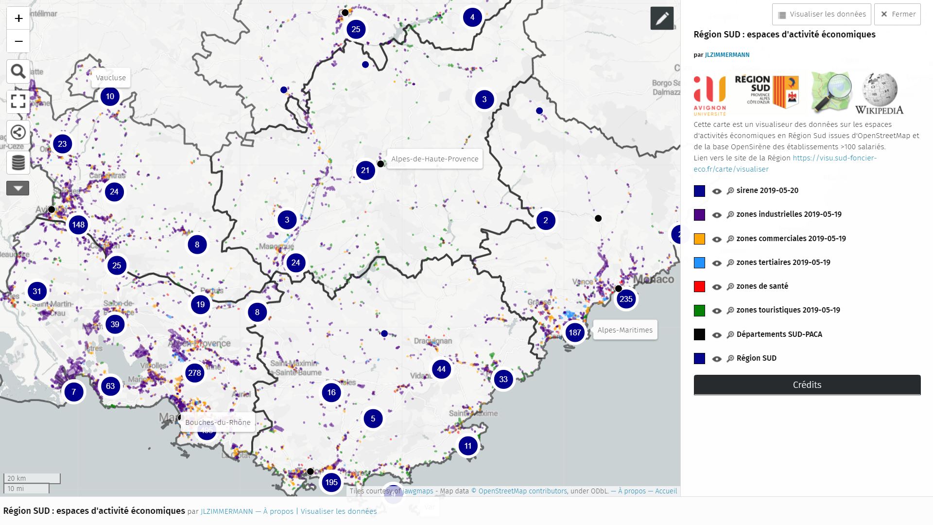
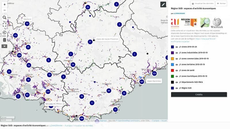
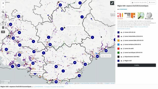
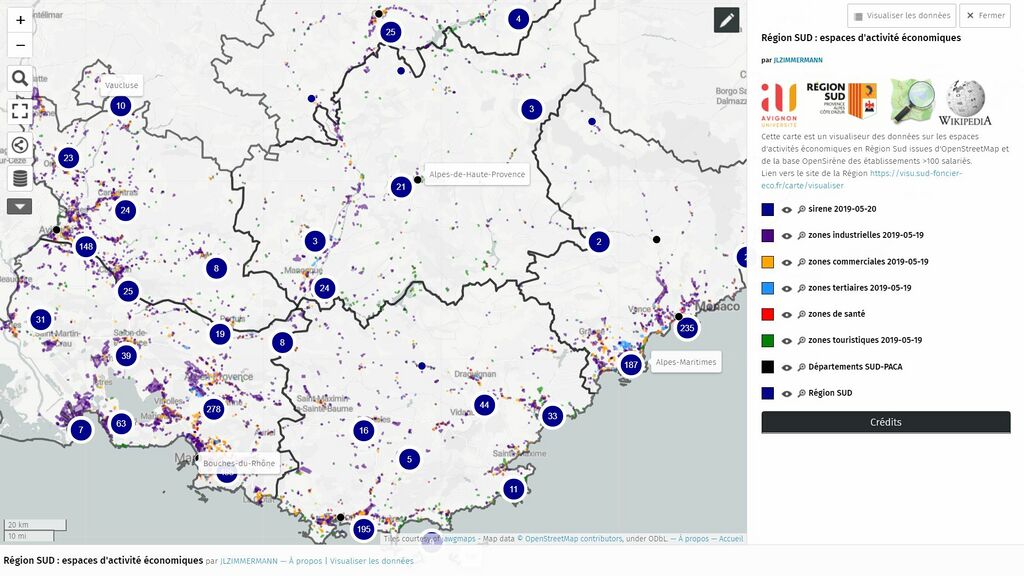
Carte Umap de 2019 issue du travail de qualification des espaces d'activités économiques en région SUD et du balayage de la classe 121 de Corine Land Cover.
Licensing
![]()
![]()
![]()
This work is licensed under the Creative Commons Attribution-ShareAlike 4.0 License.
Attribution not specified as a parameter! THIS LICENSE ALWAYS REQUIRES ATTRIBUTION! Use {{CC-BY-SA-4.0|Attribution, typically name of author}} See Template:CC-BY-SA-4.0 for full description this template should be used.
Attribution not specified as a parameter! THIS LICENSE ALWAYS REQUIRES ATTRIBUTION! Use {{CC-BY-SA-4.0|Attribution, typically name of author}} See Template:CC-BY-SA-4.0 for full description this template should be used.
| Contains map data © OpenStreetMap contributors, made available under the terms of the Open Database License (ODbL).
The ODbL does not require any particular license for maps produced from ODbL data, produced maps may be subject also to other licences. |
File history
Click on a date/time to view the file as it appeared at that time.
| Date/Time | Thumbnail | Dimensions | User | Comment | |
|---|---|---|---|---|---|
| current | 20:54, 5 September 2021 | | 1,920 × 1,080 (279 KB) | J-Louis ZIMMERMANN (talk | contribs) | Carte Umap de 2019 issue du travail de qualification des espaces d'activités économiques en région SUD et du balayage de la classe 121 de Corine Land Cover. |
You cannot overwrite this file.
File usage
The following page uses this file: