File:Cadastre-Style-Hausen-adZ.svg
Jump to navigation
Jump to search


Size of this PNG preview of this SVG file: 800 × 307 pixels. Other resolutions: 320 × 123 pixels | 640 × 246 pixels | 1,024 × 393 pixels | 1,280 × 491 pixels | 1,373 × 527 pixels.
Original file (SVG file, nominally 1,373 × 527 pixels, file size: 102 KB)
Summary
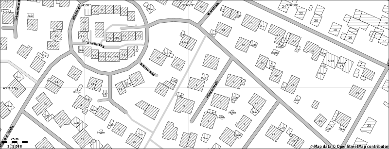
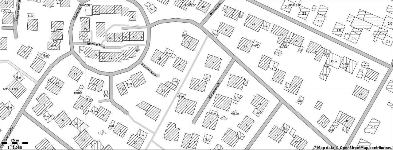
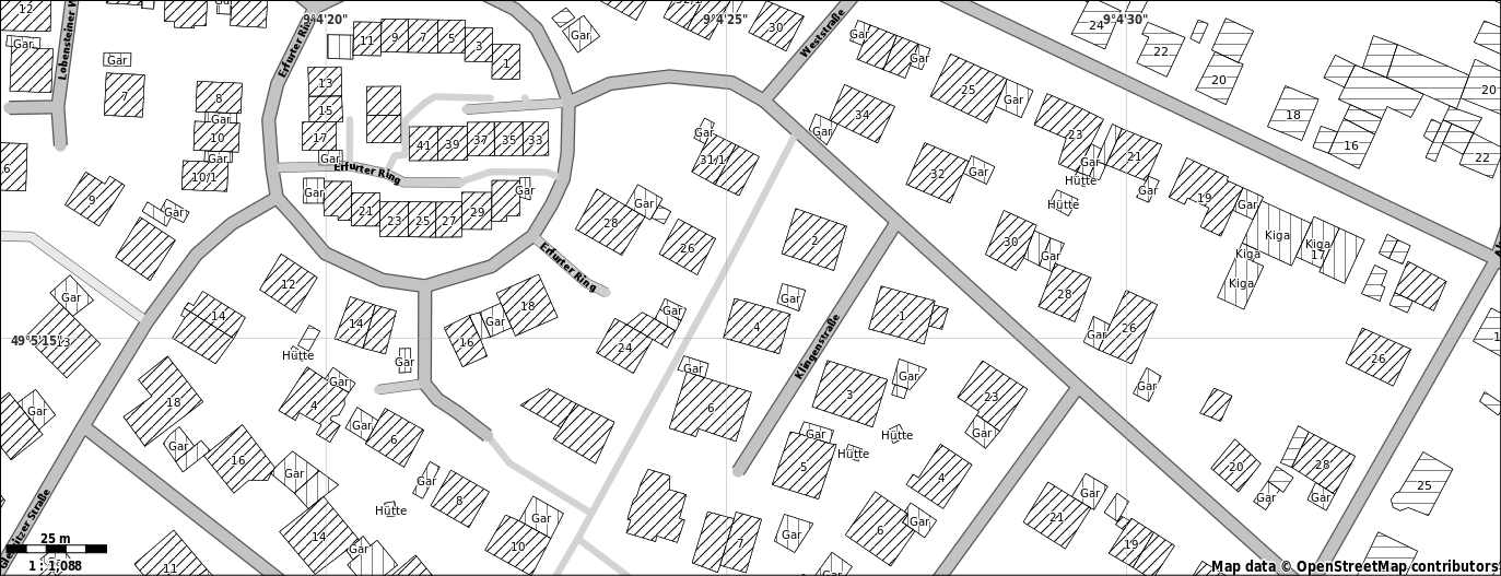
Hausen an der Zaber mit dem Cadastre Style mit Maperitive gerendert. http://www.openstreetmap.org/?lat=49.079091&lon=9.104721&zoom=18&layers=M
Licensing
![]()
![]()
![]()
This work is licensed under the Creative Commons Attribution-ShareAlike 2.0 License.
Attribution not specified as a parameter! THIS LICENSE ALWAYS REQUIRES ATTRIBUTION! Use {{CC-BY-SA-2.0|Attribution, typically name of author}} See Template:CC-BY-SA-2.0 for full description how this template should be used.
Note, there is
There is also
Attribution not specified as a parameter! THIS LICENSE ALWAYS REQUIRES ATTRIBUTION! Use {{CC-BY-SA-2.0|Attribution, typically name of author}} See Template:CC-BY-SA-2.0 for full description how this template should be used.
Note, there is
{{CC-BY-SA-2.0 OpenStreetMap}} for files based on old OSM map data, before the license change made on 2012-09-12.There is also
{{OSM Carto screenshot||old_license}} for files based on old OSM map data, before the license change made on 2012-09-12, created using OSM Carto map style.
File history
Click on a date/time to view the file as it appeared at that time.
| Date/Time | Thumbnail | Dimensions | User | Comment | |
|---|---|---|---|---|---|
| current | 16:02, 23 February 2013 | 1,373 × 527 (102 KB) | Nakaner (talk | contribs) | neue Version des Stylesheets mit schmaleren Randlinien und weiteren kleineren Verbesserungen. Ausschnitt geändert auf Dürrenzimmern, Stadt Brackenheim, Landkreis Heilbronn | |
| 17:32, 16 February 2013 |  | 1,076 × 458 (38 KB) | Nakaner (talk | contribs) | übersichtlichere Karte in höhere Zoomstufe | |
| 15:41, 16 February 2013 |  | 525 × 223 (90 KB) | Nakaner (talk | contribs) | Hausen an der Zaber mit dem Cadastre Style mit Maperitive gerendert. http://www.openstreetmap.org/?lat=49.079091&lon=9.104721&zoom=18&layers=M |
You cannot overwrite this file.
File usage
The following 2 pages use this file: