File:Edge of the Danger Area - geograph.org.uk - 1298659.jpg
Jump to navigation
Jump to search


No higher resolution available.
Edge_of_the_Danger_Area_-_geograph.org.uk_-_1298659.jpg (640 × 427 pixels, file size: 81 KB, MIME type: image/jpeg)
This file and its description are from Wikimedia Commons.
Summary
| Description |
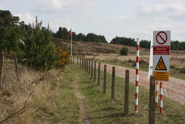
English: Edge of the Danger Area Footpath along the edge of the military Danger Area, showing two red flags prohibiting entry. |
| Date | |
| Source | From geograph.org.uk |
| Author | Paul Smith |
| Camera location | | View this and other nearby images on: OpenStreetMap |
|---|
_heading:45.00&language=en)
| Object location | | View this and other nearby images on: OpenStreetMap |
|---|
_heading:45.00&language=en)
Licensing

|
This image was taken from the Geograph project collection. See this photograph's page on the Geograph website for the photographer's contact details. The copyright on this image is owned by Paul Smith and is licensed for reuse under the Creative Commons Attribution-ShareAlike 2.0 license.
|
This file is licensed under the Creative Commons Attribution-Share Alike 2.0 Generic license.
Attribution: Paul Smith
- You are free:
- to share – to copy, distribute and transmit the work
- to remix – to adapt the work
- Under the following conditions:
- attribution – You must give appropriate credit, provide a link to the license, and indicate if changes were made. You may do so in any reasonable manner, but not in any way that suggests the licensor endorses you or your use.
- share alike – If you remix, transform, or build upon the material, you must distribute your contributions under the same or compatible license as the original.
File history
Click on a date/time to view the file as it appeared at that time.
| Date/Time | Thumbnail | Dimensions | User | Comment | |
|---|---|---|---|---|---|
| current | 09:24, 27 February 2011 | | 640 × 427 (81 KB) | wikimediacommons>GeographBot | == {{int:filedesc}} == {{Information |description={{en|1=Edge of the Danger Area Footpath along the edge of the military Danger Area, showing two red flags prohibiting entry.}} |date=2009-05-10 |source=From [http://www.geograph.org.uk/photo/1298659 geogra |
File usage
The following 42 pages use this file:
- Ar:Map Features
- Az:Map Features
- Cs:Key:military
- Cs:Map Features2
- Da:Map Features
- Fi:Kartan ominaisuudet
- Hu:Map Features
- Pt:Key:military
- Pt:Map Features2
- Ro:Map Features
- Sv:Map Features
- Uk:Об'єкти мапи
- Zh-hant:Map Features
- Template:Ar:Map Features:military
- Template:Az:Map Features:military
- Template:Cs:Map Features:military
- Template:DE:Map Features:military
- Template:Da:Map Features:military
- Template:FR:Map Features:military
- Template:Fi:Map Features:military
- Template:Generic:ES:Map Features:military
- Template:Generic:Map Features:military
- Template:Hu:Map Features:military
- Template:IT:Map Features:military
- Template:JA:Map Features:military
- Template:NL:Map Features:military
- Template:Pl:Map Features:military
- Template:Pt:Map Features:military
- Template:RU:Map Features:military
- Template:Uk:Map Features:military
- Template:Zh-hant:Map Features:military
- DE:Key:military
- DE:Map Features
- FR:Key:military
- FR:Éléments cartographiques
- IT:Key:military
- IT:Map Features
- NL:Kaartelementen
- NL:Key:military
- RU:Key:military
- JA:Key:military
- JA:Map Features