File:Hydropower dam area.png
Jump to navigation
Jump to search

No higher resolution available.
Hydropower_dam_area.png (774 × 573 pixels, file size: 66 KB, MIME type: image/png)
Summary
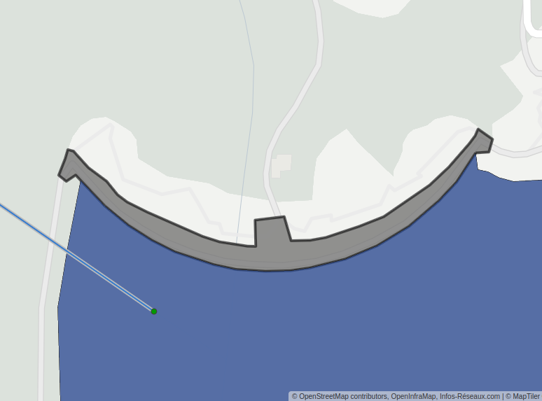
| Description | How to map a dam as an area on OSM |
|---|---|
| Author | François Lacombe |
| Source | OpenStreetMap contributors |
| Date | 2022-12-18 |
Licensing
- This media file was uploaded by author of the work and its copyright holder.
![]()
![]()
This work is licensed under the Creative Commons Attribution 4.0 License.
Attribution: François Lacombe
Attribution: François Lacombe
| Contains map data © OpenStreetMap contributors, made available under the terms of the Open Database License (ODbL).
The ODbL does not require any particular license for maps produced from ODbL data, produced maps may be subject also to other licences. |
File history
Click on a date/time to view the file as it appeared at that time.
| Date/Time | Thumbnail | Dimensions | User | Comment | |
|---|---|---|---|---|---|
| current | 22:12, 18 December 2022 | | 774 × 573 (66 KB) | Fanfouer (talk | contribs) | {{Information | description=How to map a dam as an area on OSM | source=OpenStreetMap contributors | date=2022-12-18 | author=François Lacombe | other_versions= }} |
You cannot overwrite this file.
File usage
The following 2 pages use this file: