File:Kennedy's hut edit.jpg

Original file (1,600 × 1,067 pixels, file size: 667 KB, MIME type: image/jpeg)
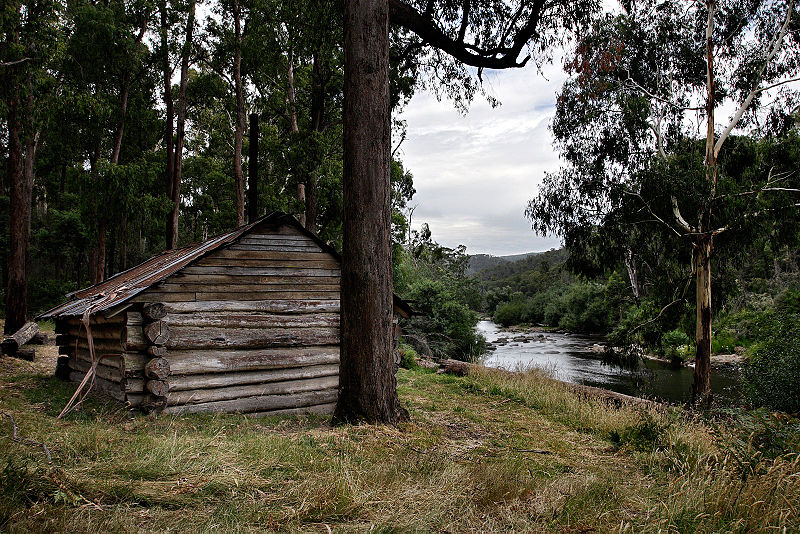
Kennedy's Hut, Alpine Country, East Gippsland, Victoria, Australia
Located on the west bank of the Mitta-Mitta river, about 1 km downstream from the AWT bridge at Taylors crossing and showing on the Benambra Leinstar map at GR 585252, not at 590260 as previously reported.
History
The hut was built by Pat Bourke Kennedy in 1967, with assistance of Grace Bourke-Keneddy, Camilla Faithfull and Ker Faithfull, after he took up the lease on 1 December 1965 and applied to build a hut on 25 July 1966.
It was used to support cattle grazing and for recreation. Repairs were last done by the Cooksey family in 2001.
|


| ||||||||


|
Permission is granted to copy, distribute and/or modify this document under the terms of the GNU Free Documentation License, Version 1.2 only as published by the Free Software Foundation; with no Invariant Sections, no Front-Cover Texts, and no Back-Cover Texts. A copy of the license is included in the section entitled GNU Free Documentation License. | 1.2 only |
This file is published under the following Creative Commons license:
Attribution NonCommercial Unported 3.0 |
File history
Click on a date/time to view the file as it appeared at that time.
| Date/Time | Thumbnail | Dimensions | User | Comment | |
|---|---|---|---|---|---|
| current | 10:01, 2 April 2006 | | 1,600 × 1,067 (667 KB) | wikimediacommons>Fir0002 | Kennedy's Hut, Alpine Country, East Gippsland, Victoria, Australia Located on the west bank of the Mitta-Mitta river, about 1 km downstream from the AWT bridge at Taylors crossing and showing on the Benambra Leinstar map at GR 585252, not at 590260 as p |
File usage
The following 68 pages use this file:
- Ast:Map Features
- Bg:Key:building
- Buildings
- Ca:Elements cartogràfics
- Ca:Key:building
- Cs:Key:building
- Cs:Map Features
- El:Map Features
- Eo:Map Features
- Fa:Map Features
- Hu:Key:building
- Key:building
- Ko:Key:building
- Ko:건물
- Ko:지도 지물
- Map features
- Ne:Map Features
- Pl:Key:building
- Pt:Key:building
- Pt:Map Features
- Sr:Map Features
- Sv:Buildings
- Uk:Key:building
- Uk:Об'єкти мапи
- Yue:Key:building
- Yue:Tag:building=hut
- Zh-hans:Key:building
- Zh-hans:Map Features
- Zh-hant:Key:building
- Zh-hant:Map Features
- Wiki:Files used by data items/3
- Template:Bg:Building typology
- Template:Building typology
- Template:Ca:Building typology
- Template:Cs:Building typology
- Template:DE:Building typology
- Template:El:Building typology
- Template:Eo:Building typology
- Template:FR:Building typology
- Template:Generic:ES:Building typology
- Template:Hu:Building typology
- Template:IT:Building typology
- Template:JA:Building typology
- Template:Ko:Building typology
- Template:NL:Building typology
- Template:Pl:Building typology
- Template:Pt:Building typology
- Template:RU:Building typology
- Template:Sv:Building typology
- Template:Uk:Building typology
- Template:Yue:Building typology
- Template:Zh-hans:Building typology
- Template:Zh-hant:Building typology
- DE:Key:building
- DE:Map Features
- FR:Key:building
- FR:Éléments cartographiques
- IT:Buildings
- IT:Key:building
- IT:Map Features
- NL:Kaartelementen
- NL:Key:building
- RU:Key:building
- RU:Tag:building=hut
- RU:Объекты карты
- JA:Key:building
- JA:Map Features
- JA:Tag:building=hut