File:Mapping-Features-Railroad-With-Station.png
Jump to navigation
Jump to search

No higher resolution available.
Mapping-Features-Railroad-With-Station.png (689 × 459 pixels, file size: 929 KB, MIME type: image/png)
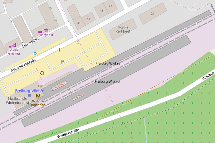
OSM Carto rendering of a railway line with station.
Licensing
![]()
![]()
This screenshot contains OpenStreetMap Carto rendering.
The OpenStreetMap Carto map style is made available under the Creative Commons CC-0 1.0 Universal Public Domain Dedication.
- Attribution to the map data:
| Contains map data © OpenStreetMap contributors, made available under the terms of the Open Database License (ODbL).
The ODbL does not require any particular license for maps produced from ODbL data, produced maps may be subject also to other licences. |
File history
Click on a date/time to view the file as it appeared at that time.
| Date/Time | Thumbnail | Dimensions | User | Comment | |
|---|---|---|---|---|---|
| current | 19:59, 4 June 2015 | | 689 × 459 (929 KB) | Rza31 (talk | contribs) | |
| 10:43, 6 February 2007 | 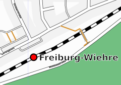 | 240 × 169 (28 KB) | Joto (talk | contribs) | Osmarender rendering of a railway line with station. |
You cannot overwrite this file.
File usage
The following 36 pages use this file:
- Bs:Map Features
- HOT - PDC InAWARE Indonesia Mapping Project
- HOT - PDC InaWARE Indonesia Project (Surabaya & Jakarta)
- Hr:Key:railway
- Hr:Map Features
- Hu:Key:railway
- Id:Fasilitas Transportasi
- Id:Indonesian Tagging Guidelines
- Id:Map Features
- Indonesian Tagging Guidelines
- Ka:Map Features
- Key:railway
- Ko:지도 지물
- PDC InaWARE Indonesia Project Tagging Guidelines
- Pl:Key:railway
- Pl:Key:railway:area
- Pt:Key:railway
- Ro:Map Features
- Sk:Map Features
- Uk:Key:railway
- Zh-hans:Key:railway
- User:OnTour/Map Features
- User:Thomas Wood/Map Key
- Wiki:Files used by data items/3
- Template:Bs:Map Features:railway
- Template:Hr:Map Features:railway
- Template:Id:Map Features:railway
- Template:Ka:Map Features:railway
- Template:Ro:Map Features:railway
- DE:Key:railway
- FR:Key:railway
- ES:Key:railway
- IT:Key:railway
- RU:Key:railway
- JA:Key:railway
- Proposal:Railway Schematic Mapping