File:Ohio township mapping status.svg
Jump to navigation
Jump to search


Size of this PNG preview of this SVG file: 600 × 600 pixels. Other resolutions: 240 × 240 pixels | 480 × 480 pixels | 768 × 768 pixels | 1,024 × 1,024 pixels | 810 × 810 pixels.
Original file (SVG file, nominally 810 × 810 pixels, file size: 33 KB)
Summary
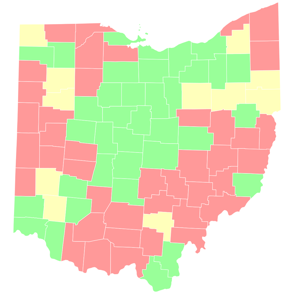
| Description | Map of Ohio counties by whether their townships have been mapped. Green = fully mapped; yellow = partially mapped; red = not mapped. |
|---|---|
| Author | User:EllieNyaa |
| Source | Derived from File:Ohio county map, cb 500k.svg. |
| Date | 2023-05-27 |
Licensing
![]()
![]()
This file is made available under the Creative Commons CC0 1.0 Universal Public Domain Dedication.
The person who associated a work with this deed has dedicated the work to the public domain by waiving all of his or her rights to the work worldwide under copyright law, including all related and neighboring rights, to the extent allowed by law. You can copy, modify, distribute and perform the work, even for commercial purposes, all without asking permission.
File history
Click on a date/time to view the file as it appeared at that time.
| Date/Time | Thumbnail | Dimensions | User | Comment | |
|---|---|---|---|---|---|
| current | 16:15, 28 May 2023 | | 810 × 810 (33 KB) | Ottwiz (talk | contribs) | Coshocton county has its townships mapped |
| 21:59, 27 May 2023 |  | 810 × 810 (34 KB) | EllieNyaa (talk | contribs) | checked a few counties | |
| 21:49, 27 May 2023 |  | 810 × 810 (34 KB) | EllieNyaa (talk | contribs) | {{Information | description=Map of Ohio counties by whether their townships have been mapped. Green = fully mapped; yellow = partially mapped; red = not mapped. | source=Derived from File:Ohio county map, cb 500k.svg. | date=2023-05-27 | author=User:EllieNyaa | other_versions= }} |
You cannot overwrite this file.
File usage
The following page uses this file: