File:Radio Tower RK Moravce S50G Slivna Slovenia.png
Jump to navigation
Jump to search


Size of this preview: 498 × 599 pixels. Other resolutions: 199 × 240 pixels | 582 × 700 pixels.
Original file (582 × 700 pixels, file size: 129 KB, MIME type: image/png)
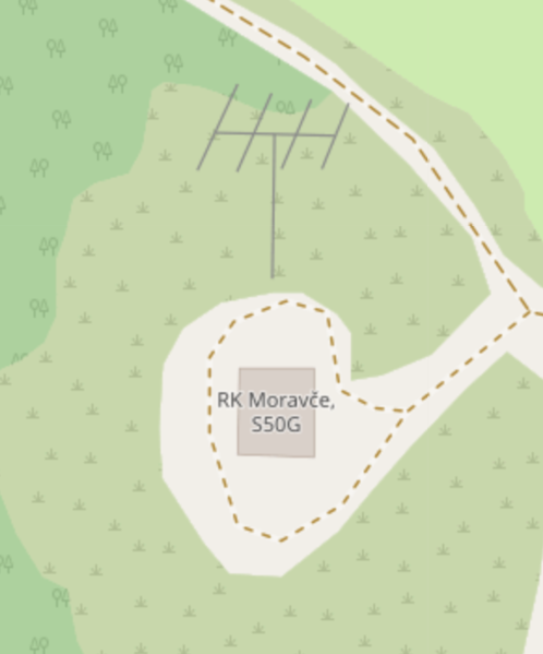
Summary
Radio amateur station used powerlines to draw an antenna symbol https://www.openstreetmap.org/#map=19/46.11837/14.80524
Licensing
| Contains map data © OpenStreetMap contributors, made available under the terms of the Open Database License (ODbL).
The ODbL does not require any particular license for maps produced from ODbL data, produced maps may be subject also to other licences. |
File history
Click on a date/time to view the file as it appeared at that time.
| Date/Time | Thumbnail | Dimensions | User | Comment | |
|---|---|---|---|---|---|
| current | 12:28, 22 October 2019 | | 582 × 700 (129 KB) | Stefanb (talk | contribs) | Radio amateur station used powerlines to draw an antenna symbol https://www.openstreetmap.org/#map=19/46.11837/14.80524 |
You cannot overwrite this file.
File usage
The following 6 pages use this file: