File:Rotterdam Fietspad Westzeedijk.jpg
Jump to navigation
Jump to search


Size of this preview: 800 × 596 pixels. Other resolutions: 320 × 238 pixels | 640 × 477 pixels | 976 × 727 pixels.
Original file (976 × 727 pixels, file size: 171 KB, MIME type: image/jpeg)
This file and its description are from Wikimedia Commons.
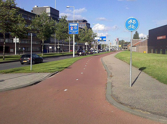
Photo showing separated cycleway with traffic sign
Summary
| Description |
English: The bicycle path from the crossing Westzeedijk-Pieter de Hooghweg in North-East direction in Rotterdam.
Nederlands: Het fietspad vanaf de kruising Westzeedijk-Pieter de Hooghweg in noord-oostelijke richting in Rotterdam. |
| Date | |
| Source | Own work |
| Author | Emvee |
| Camera location | | View this and other nearby images on: OpenStreetMap |
|---|
Licensing
I, the copyright holder of this work, hereby publish it under the following licenses:
This file is licensed under the Creative Commons Attribution-Share Alike 3.0 Unported license.
- You are free:
- to share – to copy, distribute and transmit the work
- to remix – to adapt the work
- Under the following conditions:
- attribution – You must give appropriate credit, provide a link to the license, and indicate if changes were made. You may do so in any reasonable manner, but not in any way that suggests the licensor endorses you or your use.
- share alike – If you remix, transform, or build upon the material, you must distribute your contributions under the same or compatible license as the original.

|
Permission is granted to copy, distribute and/or modify this document under the terms of the GNU Free Documentation License, Version 1.2 or any later version published by the Free Software Foundation; with no Invariant Sections, no Front-Cover Texts, and no Back-Cover Texts. A copy of the license is included in the section entitled GNU Free Documentation License. |
You may select the license of your choice.
File history
Click on a date/time to view the file as it appeared at that time.
| Date/Time | Thumbnail | Dimensions | User | Comment | |
|---|---|---|---|---|---|
| current | 15:49, 19 September 2010 | | 976 × 727 (171 KB) | wikimediacommons>Emvee~commonswiki | Better cut-out, retouched shadows |
File usage
More than 100 pages use this file. The following list shows the first 100 pages that use this file only. A full list is available.
- Ar:Map Features
- Ast:Map Features
- Bg:Map Features
- Bs:Map Features
- Ca:Elements cartogràfics
- Cs:Key:highway
- Cs:Map Features
- Da:Map Features
- El:Map Features
- Eo:Map Features
- Et:Key:highway
- Et:Map Features/old
- Fa:Key:highway
- Fa:Map Features
- Fi:Kartan ominaisuudet
- He:Map Features
- Hr:Map Features
- Hu:Key:highway
- Hu:Map Features
- Id:Map Features
- Ka:Map Features
- Key:highway
- Ko:Key:highway
- Ko:지도 지물
- Lt:Map Features
- Lv:Map Features
- Map features
- Mk:Map Features
- Ne:Map Features
- Oc:Elements cartografics
- Pl:Key:highway
- Pt:Key:highway
- Pt:Map Features
- Ro-md:Map Features
- Ro:Map Features
- Sq:Key:highway
- Sq:Map Features
- Sr:Map Features
- Sv:Map Features
- Tr:Key:highway
- Tr:Map Features
- Uk:Key:highway
- Uk:Об'єкти мапи
- Vi:Map Features
- WikiProject Bosna i Hercegovina/Biciklisticke Staze
- Yue:Key:highway
- Zh-hans:Key:highway
- Zh-hans:Map Features
- Zh-hant:Map Features
- User:Austi1996/Guide Spielplätze
- User:Chillly/Simple Map Features
- User:EdLoach/TMFP Highway
- User:Gmbo/Motorrad
- User:H4ck3rm1k3/OSMKeys
- File talk:Cycleway-markings.jpg
- Template:Ar:Map Features:highway
- Template:BG:Map Features:highway
- Template:Bs:Map Features:cycleway
- Template:Bs:Map Features:highway
- Template:Ca:Map Features:highway
- Template:Cs:Map Features:highway
- Template:DE:Map Features:highway
- Template:Da:Map Features:highway
- Template:El:Map Features:highway
- Template:Et:Map Features:highway
- Template:FR:Map Features:highway
- Template:Fa:Map Features:highway
- Template:Fi:Map Features:highway
- Template:Hr:Map Features:highway
- Template:Hu:Map Features:highway
- Template:IT:Map Features:highway
- Template:Id:Map Features:highway
- Template:JA:Map Features:highway
- Template:Ka:Map Features:highway
- Template:Ko:Map Features:highway
- Template:Map Features:highway
- Template:Mk:Map Features:highway
- Template:NL:Map Features:highway
- Template:Pl:Map Features:highway
- Template:Pt:Map Features:highway
- Template:RU:Map Features:highway
- Template:Ro:Map Features:highway
- Template:Sq:Map Features:highway
- Template:Tr:Map Features:highway
- Template:Uk:Map Features:highway
- Template:Vi:Map Features:highway
- Template:Yue:Map Features:highway
- Template:Zh-hans:Map Features:highway
- Template:Zh-hant:Map Features:highway
- Template:Zh-tw:Map Features:highway
- Template talk:Et:Map Features:highway
- DE:Key:highway
- DE:Map Features
- FR:Key:highway
- FR:Éléments cartographiques
- IT:Key:highway
- IT:Map Features
- NL:Kaartelementen
- RU:Key:highway
- RU:Объекты карты
View more links to this file.