File:Routing graphhoppercom.png
Jump to navigation
Jump to search

Size of this preview: 800 × 454 pixels. Other resolutions: 320 × 182 pixels | 640 × 364 pixels | 933 × 530 pixels.
Original file (933 × 530 pixels, file size: 523 KB, MIME type: image/png)
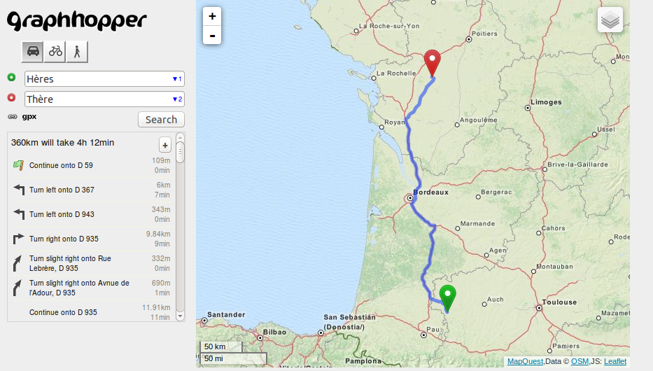
Routing from Hères, France to Thère, France using GraphHopper.com (see GraphHopper)
Licensing
| Contains map data © OpenStreetMap contributors, made available under the terms of the Open Database License (ODbL).
The ODbL does not require any particular license for maps produced from ODbL data, produced maps may be subject also to other licences. |
File history
Click on a date/time to view the file as it appeared at that time.
| Date/Time | Thumbnail | Dimensions | User | Comment | |
|---|---|---|---|---|---|
| current | 15:05, 25 January 2014 | | 933 × 530 (523 KB) | RobJN (talk | contribs) | Routing from Hères, France to Thère, France using GraphHopper.com |
You cannot overwrite this file.
File usage
The following 11 pages use this file: