File:SurreyHillsCakeComposite.png
Jump to navigation
Jump to search


Size of this preview: 800 × 435 pixels. Other resolutions: 320 × 174 pixels | 640 × 348 pixels | 1,280 × 696 pixels.
Original file (1,280 × 696 pixels, file size: 1.39 MB, MIME type: image/png)
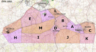
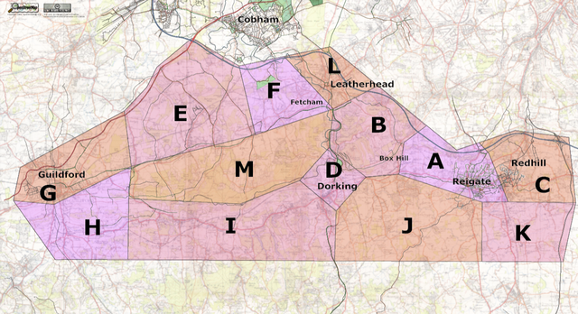
Composite map showing Surrey Hills mapping weekend with cake-zoned areas over OS New Popular Edition 1950, digitized by Nick Hill (CC-BY-SA 2.0).
File history
Click on a date/time to view the file as it appeared at that time.
| Date/Time | Thumbnail | Dimensions | User | Comment | |
|---|---|---|---|---|---|
| current | 14:29, 12 September 2006 | | 1,280 × 696 (1.39 MB) | 80n (talk | contribs) | Composite map showing Surrey Hills mapping weekend with cake-zoned areas over OS New Popular Edition 1950, digitized by Nick Hill (CC-BY-SA 2.0). |
You cannot overwrite this file.
File usage
The following page uses this file: