File:Tram pedestrian crossing, Edinburgh Park business park, 15 October 2013.jpg
Jump to navigation
Jump to search


Size of this preview: 800 × 600 pixels. Other resolutions: 320 × 240 pixels | 640 × 480 pixels | 1,024 × 768 pixels | 1,280 × 960 pixels | 2,560 × 1,920 pixels | 3,264 × 2,448 pixels.
Original file (3,264 × 2,448 pixels, file size: 4.02 MB, MIME type: image/jpeg)
This file and its description are from Wikimedia Commons.
Summary
| Description |
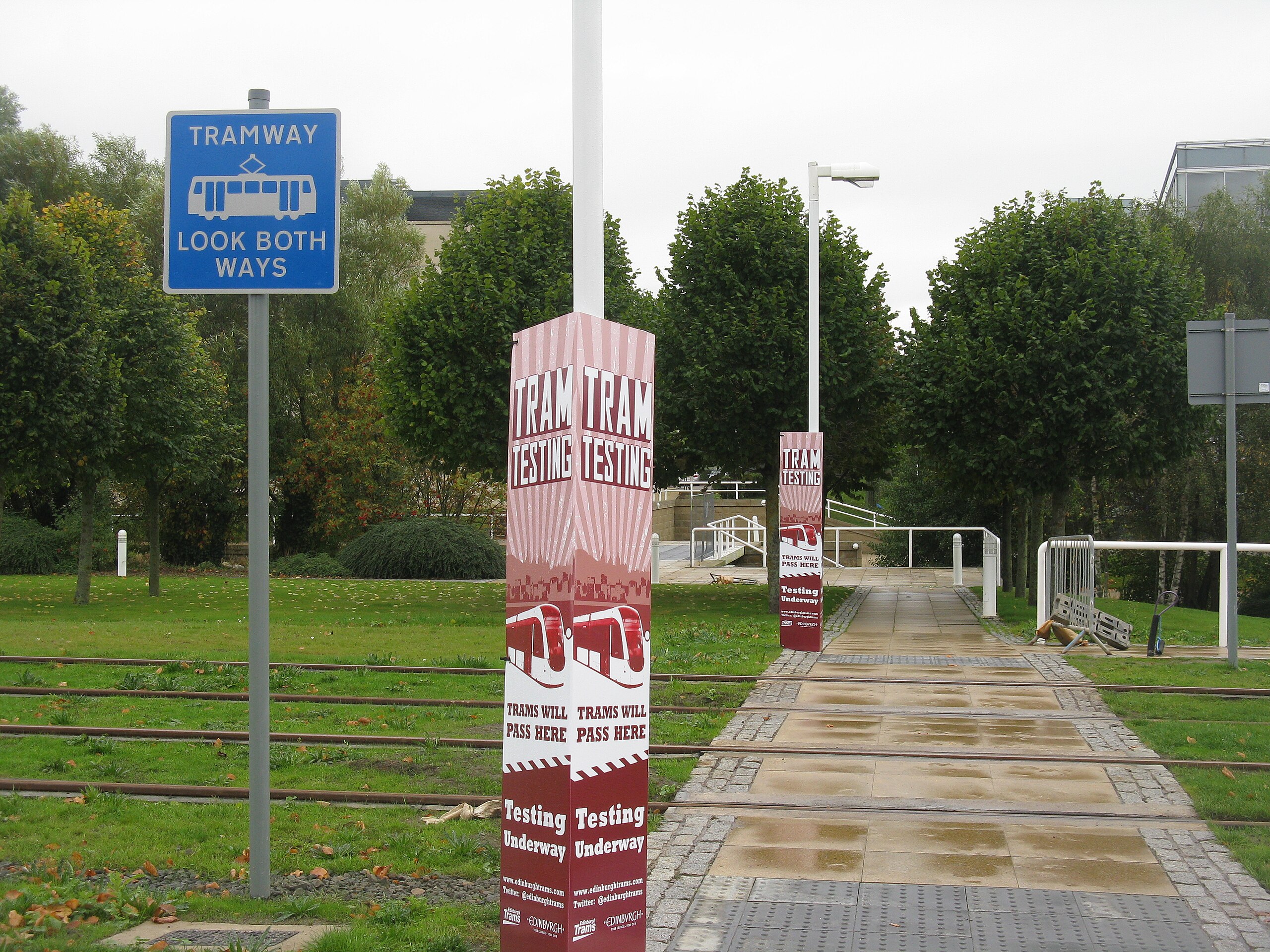
English: A pedestrian crossing on the Edinburgh Trams system, one of several that cross the line as it runs north through the Edinburgh Park business park. This one is a short distance north of the Edinburgh Park Central stop - looking west, ahead is a bridge across the Gogar Burn, while just about visible above the trees are the corners of the Keysight/Agilent building (left) and Sainsbury's Bank building (right). At this time the line was still not open to the public, but as the hoardings indicate, testing along this stretch had already begun (beginning 8 October). |
| Date | |
| Source | From geograph.org.uk |
| Author | M J Richardson |
| Permission (Reusing this file) |
Creative Commons Attribution Share-alike license 2.0 |
| Attribution (required by the license) | M J Richardson / Testing, testing, testing.... / |
| Camera location | | View this and other nearby images on: OpenStreetMap |
|---|
| Object location | | View this and other nearby images on: OpenStreetMap |
|---|
_region:GB-GBN_heading:247.00&language=en)
Licensing

|
This image was taken from the Geograph project collection. See this photograph's page on the Geograph website for the photographer's contact details. The copyright on this image is owned by M J Richardson and is licensed for reuse under the Creative Commons Attribution-ShareAlike 2.0 license.
|
This file is licensed under the Creative Commons Attribution-Share Alike 2.0 Generic license.
Attribution: M J Richardson
- You are free:
- to share – to copy, distribute and transmit the work
- to remix – to adapt the work
- Under the following conditions:
- attribution – You must give appropriate credit, provide a link to the license, and indicate if changes were made. You may do so in any reasonable manner, but not in any way that suggests the licensor endorses you or your use.
- share alike – If you remix, transform, or build upon the material, you must distribute your contributions under the same or compatible license as the original.
File history
Click on a date/time to view the file as it appeared at that time.
| Date/Time | Thumbnail | Dimensions | User | Comment | |
|---|---|---|---|---|---|
| current | 13:02, 7 February 2015 | | 3,264 × 2,448 (4.02 MB) | wikimediacommons>File Upload Bot (Magnus Manske) | Transferred from Geograph by User:Ultra7 |
File usage
The following page uses this file: