File:Ways-and-areas-borders.PNG
Jump to navigation
Jump to search

No higher resolution available.
Ways-and-areas-borders.PNG (768 × 512 pixels, file size: 78 KB, MIME type: image/png)
Summary
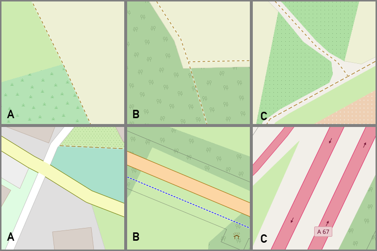
Three mapping practices are shown. A: Areas are glued to adjacent ways, shared nodes. B: Ways go though or on areas, no shared nodes, no gaps. C: Gaps between ways and areas.
Licensing
![]()
This file has been released into the public domain by the copyright holder, its copyright has expired, or it is ineligible for copyright. This applies worldwide.
Please, please use more specific template such as {{PD-self}} / {{PD-creator}} / {{PD-shape}} / {{PD-USGov}} / {{PD-old}} / {{PD-RU-exempt}} ... This template is not making clear why this work is in the public domain.
Please, please use more specific template such as {{PD-self}} / {{PD-creator}} / {{PD-shape}} / {{PD-USGov}} / {{PD-old}} / {{PD-RU-exempt}} ... This template is not making clear why this work is in the public domain.
File history
Click on a date/time to view the file as it appeared at that time.
| Date/Time | Thumbnail | Dimensions | User | Comment | |
|---|---|---|---|---|---|
| current | 12:30, 21 October 2018 | | 768 × 512 (78 KB) | Lukie80 (talk | contribs) | Three mapping practices are shown. A: Areas are glued to adjacent ways, shared nodes, B: Ways go though or on areas, no shared nodes, no gaps. C: Gaps between ways and areas. |
You cannot overwrite this file.
File usage
The following 4 pages use this file: