Tag:highway=pedestrian: Difference between revisions
(→Squares and plazas: Mention using multipolgyon if there are inners) |
Dieterdreist (talk | contribs) (→Squares and plazas: update situation) |
||
| Line 23: | Line 23: | ||
=== Squares and plazas === |
=== Squares and plazas === |
||
For many years, a closed way tagged with {{Tag|highway|pedestrian}} and {{Tag|area||yes}} was the only way to map squares and plazas. While in 2019 it is still the most common way of representing a square, you should consider using, the explicit tag {{Tag|place|square}} for named squares and use the pedestrian tag for actual pedestrian areas only. Draw the way at the outer limits of the pedestrian area, possibly even connecting with surrounding walls, fences, buildings, etc. If there are roads passing through the area, map them as usual and make connecting nodes at all intersections with the pedestrian area. Also other paths such as {{tag|highway|footway}} as well as roads have to connect with the edge of the pedestrian area where they intersect. However, note that few routers will route ''through'' the area, most will route around the ''edge'' of it. |
|||
If there are features or areas within the square or plaza which are not part of the walkable pedestrian area, these should be exluded by creating a [[multipolygon]] relation. |
If there are features or areas within the square or plaza which are not part of the walkable pedestrian area, these should be exluded by creating a [[multipolygon]] relation. |
||
To map named squares and plazas you might additionally be interested in the tag {{Tag|place|square}}. |
|||
== Vehicle access == |
== Vehicle access == |
||
Revision as of 15:22, 7 September 2019
| Description |
|---|
| Roads mainly / exclusively for pedestrians |
| Rendering in OSM Carto |

|
| Group: highways |
| Used on these elements |
| Useful combination |
| See also |
| Status: approved |
| Tools for this tag |
|
A highway=pedestrian is a road or an area mainly or exclusively for pedestrians in which some vehicle traffic may be authorized (e.g. emergency, taxi, delivery, ...). Typically found in shopping areas, town centres, places with tourism attractions and recreation/civic areas, where wide expanses of hard surface are provided for pedestrians to walk.
How to map
To map a pedestrianised road nothing other than a simple ![]() way is required. Add the highway=pedestrian tag to it and a name=* to make it complete.
For ways inside pedestrian areas that are too narrow to be considered a road, use highway=footway or highway=path.
way is required. Add the highway=pedestrian tag to it and a name=* to make it complete.
For ways inside pedestrian areas that are too narrow to be considered a road, use highway=footway or highway=path.
Squares and plazas
For many years, a closed way tagged with highway=pedestrian and area=yes was the only way to map squares and plazas. While in 2019 it is still the most common way of representing a square, you should consider using, the explicit tag place=square for named squares and use the pedestrian tag for actual pedestrian areas only. Draw the way at the outer limits of the pedestrian area, possibly even connecting with surrounding walls, fences, buildings, etc. If there are roads passing through the area, map them as usual and make connecting nodes at all intersections with the pedestrian area. Also other paths such as highway=footway as well as roads have to connect with the edge of the pedestrian area where they intersect. However, note that few routers will route through the area, most will route around the edge of it.
If there are features or areas within the square or plaza which are not part of the walkable pedestrian area, these should be exluded by creating a multipolygon relation.
Vehicle access
Vehicles may be allowed during special hours to unload merchandise, but are often prevented from entering by bollards.
Cycling may be allowed, depending on the country or local restrictions. This can be specified with bicycle=yes or bicycle=no.
For small paths which are too small for cars to pass (no real streets) use highway=footway instead.
Examples
| Picture/Description | Tags | OSM-Carto |
|---|---|---|

|
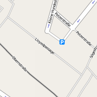
highway=pedestrian name=Lloydpassage |
 |
|
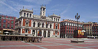
highway=pedestrian area=yes name=Weyher Marktplatz place=square |
|

|
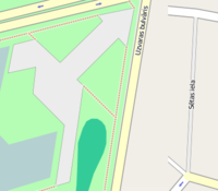
highway=pedestrian | |
|
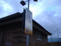
highway=pedestrian name=The Moorings motorcar=destination motorcycle=destination |
— |
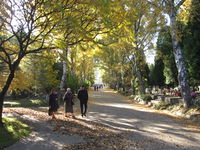
|
highway=pedestrian | https://www.openstreetmap.org/#map=19/50.09722/19.97816 |
| highway=pedestrian name=Fiskergade vehicle=yes note="Gågade" Pedestrian street with "Kørsel tilladt" vehicles allowed. Driving is allowed here, but (tourist)pedestrians are prioritized higher, so motorists basically can't expect to move faster than the pedestrian in front of them. Similar to highway=living_street, but slightly stricter on vehicles. |
See Also
- area:highway=pedestrian - an area representation of pedestrian streets
- highway=footway - for designated footpaths, i.e. mainly/exclusively for pedestrians
- place=square - a named square (indicates a town or village square, which is an open public space common in urban centres, such as cities, towns or villages)
- Proposed features/Pedestrianised road
| ||||||||||||||||||||||||||||||

