File:BWO map Crannoge.png
Jump to navigation
Jump to search


Size of this preview: 724 × 600 pixels. Other resolutions: 290 × 240 pixels | 580 × 480 pixels | 874 × 724 pixels.
Original file (874 × 724 pixels, file size: 386 KB, MIME type: image/png)
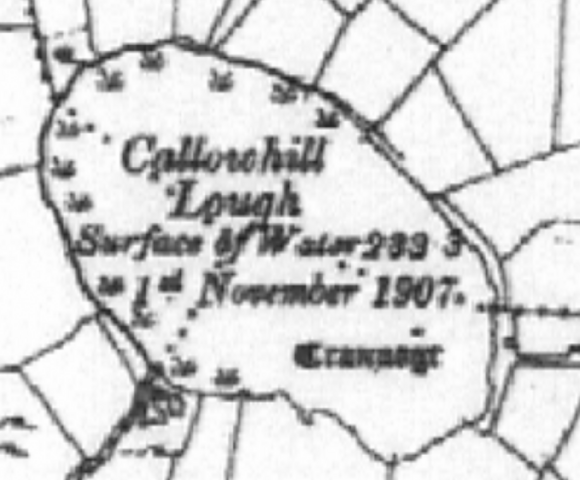
Screenshot of the British War office map showing a crannóg in Co. Leitrim, Ireland
File history
Click on a date/time to view the file as it appeared at that time.
| Date/Time | Thumbnail | Dimensions | User | Comment | |
|---|---|---|---|---|---|
| current | 15:29, 11 September 2022 | | 874 × 724 (386 KB) | B-unicycling (talk | contribs) |
You cannot overwrite this file.
File usage
The following 3 pages use this file: