File:Bengaluru Urban Area Map.png
Jump to navigation
Jump to search


Size of this preview: 800 × 561 pixels. Other resolutions: 320 × 224 pixels | 640 × 448 pixels | 1,024 × 718 pixels | 1,156 × 810 pixels.
Original file (1,156 × 810 pixels, file size: 2.22 MB, MIME type: image/png)
This file and its description are from Wikimedia Commons.
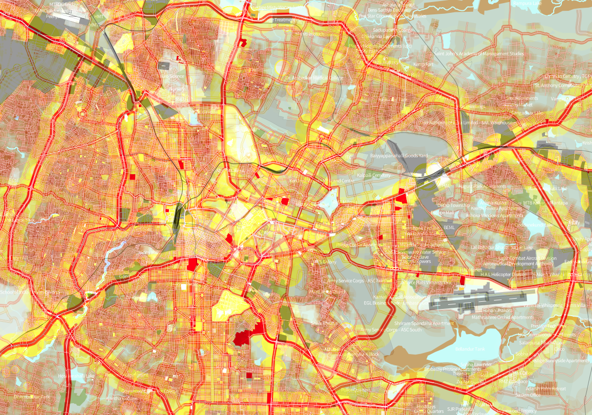
Map of Bengaluru (shown area's bbox), India, showing the streets network and built up area.
This is a Featured image, which means that it has been identified as one of the best examples of OpenStreetMap mapping, or that it provides a useful illustration of the OpenStreetMap project. If you know another image of similar quality, you can nominate it on Featured image proposals.
Front-page image for week 8 of 2014 (17–23 Feb.).
- Image descriptions
- Deutsch : Straßennetz und bebaute Fläche von Bangalore (Indien). Diese farbenfrohe Karte wurde mit TileMill aus OSM-Daten erstellt.
- English : Street network and built-up area of Bangalore (India). This colourful map was made based on OSM data using TileMill.
- español : Red de la calle y área urbanizada de Bangalore (India). Este mapa colorido fue hecho tomando como base los datos de OSM utilizando TileMill.
- italiano : La rete stradale e le aree edificate di Bangalore (India). Questa mappa colorata è stata fatta basandosi su dati OSM usando TileMill.
- русский : Карта дорожной сети и зон застройки индийского города Бангалор, созданная с помощью данных ОСМ и приложения TileMill.
- 中文(繁體) : 印度班加羅爾一帶的路網和城市房屋區。這個彩色地圖以開放街圖圖資為底,用TileMill處理。
Summary
| Description |
English: Map of Bengaluru, India, showing the streets network and built up area. Data: ODbL, Openstreetmap Project. ([1]) |
| Date | |
| Source | Own work + OpenStreetMap data |
| Author | Planemad |
Licensing
Map data license:
| This work contains information from OpenStreetMap, which is made available under the Open Database License (ODbL).
The ODbL does not require any particular license for maps produced from ODbL data. Prior to 1 August 2020, map tiles produced by the OpenStreetMap Foundation were licensed under the CC-BY-SA-2.0 license. Maps produced by other people may be subject to other licences. |
"Produced work" image license:
I, the copyright holder of this work, hereby publish it under the following license:
This file is licensed under the Creative Commons Attribution-Share Alike 3.0 Unported license.
- You are free:
- to share – to copy, distribute and transmit the work
- to remix – to adapt the work
- Under the following conditions:
- attribution – You must give appropriate credit, provide a link to the license, and indicate if changes were made. You may do so in any reasonable manner, but not in any way that suggests the licensor endorses you or your use.
- share alike – If you remix, transform, or build upon the material, you must distribute your contributions under the same or compatible license as the original.
File history
Click on a date/time to view the file as it appeared at that time.
| Date/Time | Thumbnail | Dimensions | User | Comment | |
|---|---|---|---|---|---|
| current | 21:25, 10 April 2013 | | 1,156 × 810 (2.22 MB) | wikimediacommons>Planemad | User created page with UploadWizard |
File usage
The following 7 pages use this file: