File:Central london coverage.png
Central_london_coverage.png (640 × 468 pixels, file size: 391 KB, MIME type: image/png)
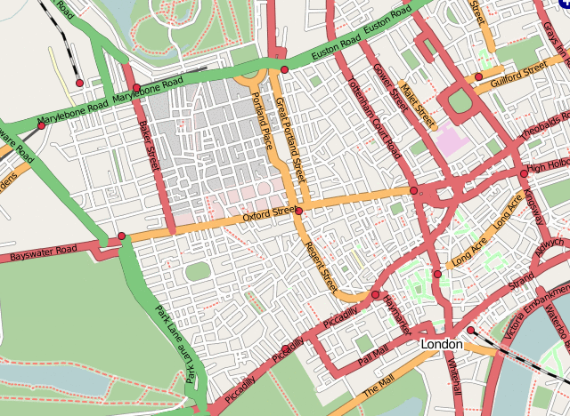
This is a Mapnik rendering of the West End showing the full length of Oxford Street and areas around.
With a good level of mapping completeness at March 2007, it has been a Featured image.
However it does show some unmapped areas around Edgware Road and Marylebone. An Osmarender view would show that segments are present for all the streets in this area, but they have not been set as ways and tagged with street names. These un-wayyed segments don't show up in a Mapnik rendering.
It also has some rendering weirdness because one area mapped during the London mapping party has an area defined for the building types (giving it a darker grey background). We'll need to decide if other areas of central london should have this.

Front-page image on 14 Apr 2007
Licensing
![]()
![]()
![]()
The OpenStreetMap Carto map style is made available under the Creative Commons CC-0 1.0 Universal Public Domain Dedication.
- Attribution to the map data:
![]()
File history
Click on a date/time to view the file as it appeared at that time.
| Date/Time | Thumbnail | Dimensions | User | Comment | |
|---|---|---|---|---|---|
| current | 21:38, 30 March 2007 | | 640 × 468 (391 KB) | Ojw (talk | contribs) |
You cannot overwrite this file.
File usage
The following 3 pages use this file: