File:Centre zone.png
Jump to navigation
Jump to search


Size of this preview: 673 × 600 pixels. Other resolutions: 269 × 240 pixels | 539 × 480 pixels | 680 × 606 pixels.
Original file (680 × 606 pixels, file size: 120 KB, MIME type: image/png)
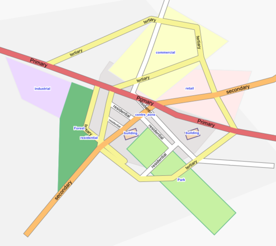
a rendering proposal for centres, tag: landuse=centre_zone, rendered in Osmarender. The rendering rules are: <rule e="way" k="landuse" v="centre_zone" layer="-5">
           <area class="landuse-centre_zone"/>
       </rule>
and the CSS-Class
       .landuse-centre_zone {
               fill: #e5e2e2;
               stroke: #dddada;
               stroke-width: 0.2px;
           }
![]()
Contains map data © OpenStreetMap contributors, made available under the terms of the Creative Commons Attribution-ShareAlike 2.0 (CC-BY-SA-2.0).
File history
Click on a date/time to view the file as it appeared at that time.
| Date/Time | Thumbnail | Dimensions | User | Comment | |
|---|---|---|---|---|---|
| current | 18:15, 20 September 2008 | | 680 × 606 (120 KB) | Dieterdreist (talk | contribs) | a rendering proposal for centres, tag: landuse=centre_zone, rendered in Osmarender. The rendering rules are: <rule e="way" k="landuse" v="centre_zone" layer="-5"> <area class="landuse-centre_zone"/> </rule> and the CSS-Class |
You cannot overwrite this file.
File usage
The following page uses this file: