File:Chile HighResolutionImagery asof 20100227.png
Jump to navigation
Jump to search

No higher resolution available.
Chile_HighResolutionImagery_asof_20100227.png (325 × 179 pixels, file size: 22 KB, MIME type: image/png)
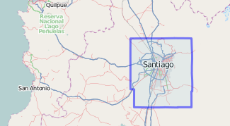
Screen shot of Potlatch showing relation described at WikiProject Chile/Imagery and data sources for boundary of Yahoo! imagery. derived from 418630![]() 418630.
418630.
Released into the public domain unless other restrictions prevent such release.
File history
Click on a date/time to view the file as it appeared at that time.
| Date/Time | Thumbnail | Dimensions | User | Comment | |
|---|---|---|---|---|---|
| current | 13:08, 28 February 2010 | | 325 × 179 (22 KB) | Ceyockey (talk | contribs) | cropped image to reduce footprint |
| 14:58, 27 February 2010 |  | 325 × 313 (51 KB) | Ceyockey (talk | contribs) | Reverted to version as of 12:41, 27 February 2010 so that it can serve primary purpose of showing imagery extent. | |
| 13:46, 27 February 2010 | 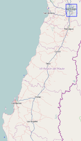 | 325 × 564 (67 KB) | Ceyockey (talk | contribs) | updated after addition of "Epicentre, Chile 20100227 10:38 UTC 5.9" | |
| 13:27, 27 February 2010 | 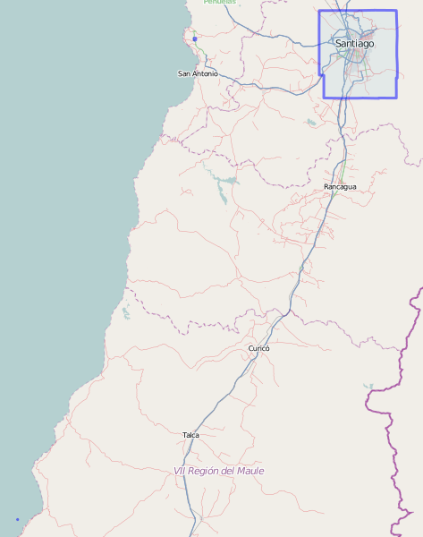 | 473 × 600 (76 KB) | Ceyockey (talk | contribs) | updated after addition of 8.8 primary epicentre to the relation and snapping a new screenshot | |
| 13:10, 27 February 2010 |  | 520 × 245 (87 KB) | Ceyockey (talk | contribs) | update to image, adding one of the aftershock epicentres (5.8 27 Jan 09:00 UTC). | |
| 12:41, 27 February 2010 | 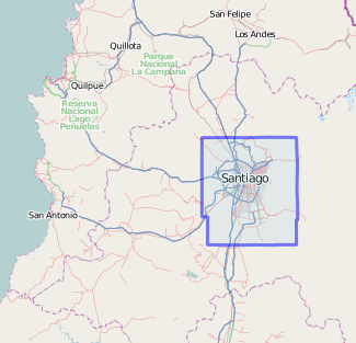 | 325 × 313 (51 KB) | Ceyockey (talk | contribs) | Screen shot of Potlatch showing relation described at WikiProject Chile/Imagery and data sources for boundary of Yahoo! imagery. Released into the public domain unless other restrictions prevent such release. |
You cannot overwrite this file.
File usage
The following page uses this file: