File:Edinburgh-A71-A8-B701-2006-03-29.png
Jump to navigation
Jump to search

Size of this preview: 800 × 554 pixels. Other resolutions: 320 × 221 pixels | 640 × 443 pixels | 831 × 575 pixels.
Original file (831 × 575 pixels, file size: 98 KB, MIME type: image/png)
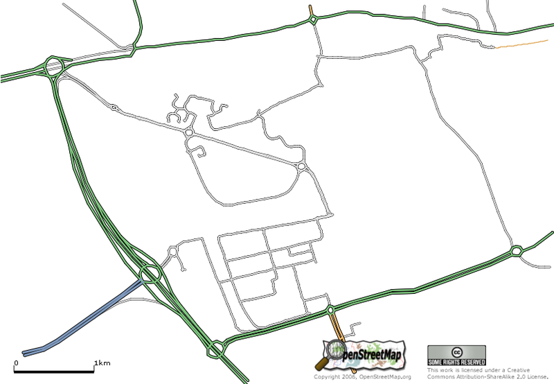
The area is part of the City of Edinburgh roughly deliniated by the City of Edinburgh Bypass (A720) to the west, the A8 to the north, the A71 to the south with the B701 running through the middle (not yet mapped)
![]()
Contains map data © OpenStreetMap contributors, made available under the terms of the Creative Commons Attribution-ShareAlike 2.0 (CC-BY-SA-2.0).
File history
Click on a date/time to view the file as it appeared at that time.
| Date/Time | Thumbnail | Dimensions | User | Comment | |
|---|---|---|---|---|---|
| current | 18:10, 29 March 2006 | | 831 × 575 (98 KB) | Colin Angus Mackay (talk | contribs) | The area is part of the City of Edinburgh roughly deliniated by the City of Edinburgh Bypass (A720) to the west, the A8 to the north, the A71 to the south with the B701 running through the middle (not yet mapped) |
You cannot overwrite this file.
File usage
The following page uses this file: