File:Foto Höhenermittelung Nachteil.jpeg
Jump to navigation
Jump to search

No higher resolution available.
Foto_Höhenermittelung_Nachteil.jpeg (483 × 440 pixels, file size: 10 KB, MIME type: image/jpeg)
Summary
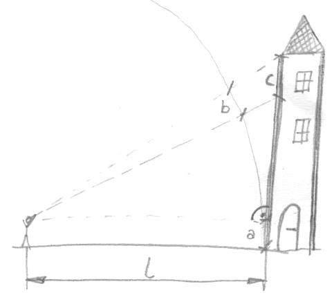
Hier ist zu sehen was passiert mit zunehmender Höhe nimmt auch der Abstand zum Objekt zu was dazu führt das mehr auf kleinerem Raum dargestellt wird. Quelle: Miche101, selbst mit der Hand gezeichnet.
Licensing
![]()
![]()
![]()
This work is licensed under the Creative Commons Attribution-ShareAlike 3.0 License.
Attribution not specified as a parameter! THIS LICENSE ALWAYS REQUIRES ATTRIBUTION! Use {{CC-BY-SA-3.0|Attribution, typically name of author}} See Template:CC-BY-SA-3.0 for full description how this template should be used.
Attribution not specified as a parameter! THIS LICENSE ALWAYS REQUIRES ATTRIBUTION! Use {{CC-BY-SA-3.0|Attribution, typically name of author}} See Template:CC-BY-SA-3.0 for full description how this template should be used.
File history
Click on a date/time to view the file as it appeared at that time.
| Date/Time | Thumbnail | Dimensions | User | Comment | |
|---|---|---|---|---|---|
| current | 11:49, 14 January 2017 | | 483 × 440 (10 KB) | Miche101 (talk | contribs) | Hier ist zu sehen was passiert mit zunehmender Höhe nimmt auch der Abstand zum Objekt zu was dazu führt das mehr auf kleinerem Raum dargestellt wird. Quelle: Miche101, selbst mit der Hand gezeichnet. |
You cannot overwrite this file.
File usage
The following page uses this file: