File:French power network capacitymap.png
Jump to navigation
Jump to search

Size of this preview: 800 × 536 pixels. Other resolutions: 320 × 214 pixels | 640 × 429 pixels | 1,024 × 686 pixels | 1,255 × 841 pixels.
Original file (1,255 × 841 pixels, file size: 1.02 MB, MIME type: image/png)
Summary
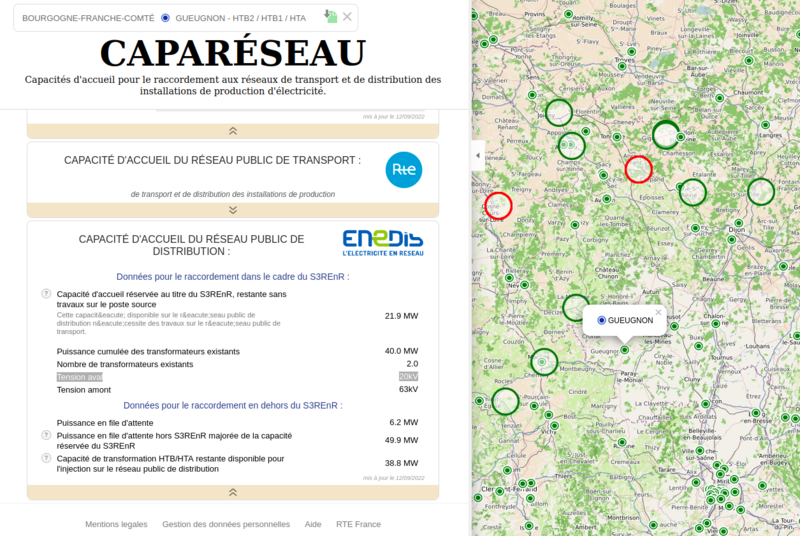
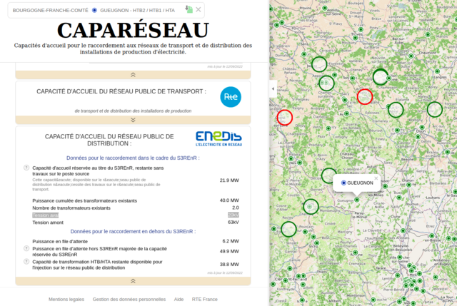
| Description | Screenshot of French power network capacity website |
|---|---|
| Author | RTE France |
| Source | www.capareseau.fr |
| Date | 2022-09-15 |
Licensing
![]()
![]()
![]()
This work is licensed under the Creative Commons Attribution-ShareAlike 4.0 License.
Attribution: RTE France
Attribution: RTE France
| Contains map data © OpenStreetMap contributors, made available under the terms of the Open Database License (ODbL).
The ODbL does not require any particular license for maps produced from ODbL data, produced maps may be subject also to other licences. |
File history
Click on a date/time to view the file as it appeared at that time.
| Date/Time | Thumbnail | Dimensions | User | Comment | |
|---|---|---|---|---|---|
| current | 17:45, 15 September 2022 | | 1,255 × 841 (1.02 MB) | Fanfouer (talk | contribs) | {{Information | description=Screenshot of French power network capacity website | source=www.capareseau.fr | date=2022-09-15 | author=RTE France | permission= | other_versions= }} |
You cannot overwrite this file.
File usage
The following page uses this file: