File:French ref gdo plate.png
Jump to navigation
Jump to search

No higher resolution available.
French_ref_gdo_plate.png (623 × 511 pixels, file size: 374 KB, MIME type: image/png)
Summary
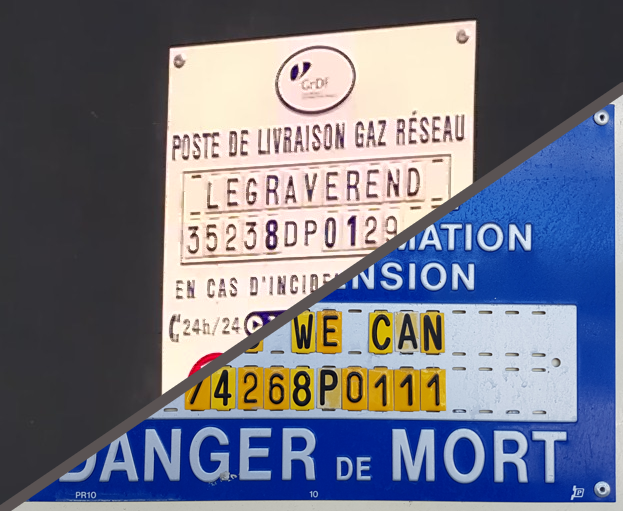
Plates used to identify on group gas and power distribution substations in continental France
François Lacombe www.infos-reseaux.com
Licensing
![]()
![]()
![]()
This work is licensed under the Creative Commons Attribution-ShareAlike 4.0 License.
Attribution: François Lacombe - www.infos-reseaux.com
Attribution: François Lacombe - www.infos-reseaux.com
File history
Click on a date/time to view the file as it appeared at that time.
| Date/Time | Thumbnail | Dimensions | User | Comment | |
|---|---|---|---|---|---|
| current | 22:40, 13 February 2020 | | 623 × 511 (374 KB) | Fanfouer (talk | contribs) | Plates used to identify on group gas and power distribution substations in continental France François Lacombe www.infos-reseaux.com |
You cannot overwrite this file.
File usage
The following 3 pages use this file: