File:ITO Map - Barriers.png
Jump to navigation
Jump to search
Size of this preview: 799 × 175 pixels. Other resolutions: 320 × 70 pixels | 1,154 × 253 pixels.
Original file (1,154 × 253 pixels, file size: 265 KB, MIME type: image/png)
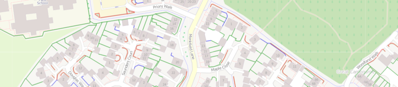
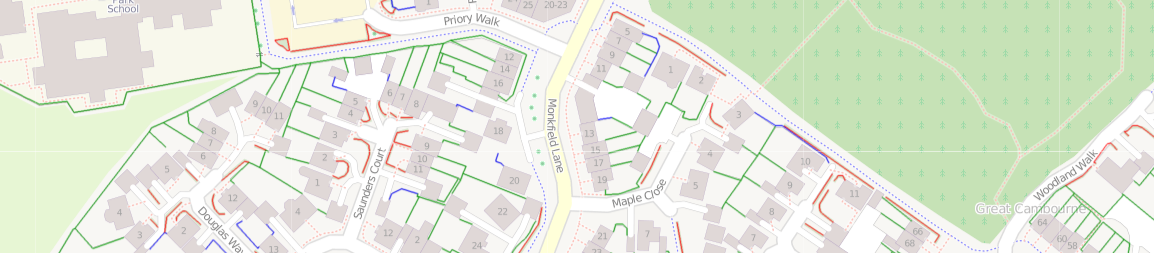
Output from ITO Map showing the Barriers overlay highlighting fences, walls and hedges in different colours.
File history
Click on a date/time to view the file as it appeared at that time.
| Date/Time | Thumbnail | Dimensions | User | Comment | |
|---|---|---|---|---|---|
| current | 20:38, 3 March 2011 | 1,154 × 253 (265 KB) | PeterIto (talk | contribs) | Output from ITO Map showing the Barriers overlay highlighting fences, walls and hedges in different colours. |
You cannot overwrite this file.
File usage
The following 4 pages use this file: