File:ITO Map - Electricity distribution.png
Jump to navigation
Jump to search

Size of this preview: 800 × 199 pixels. Other resolutions: 320 × 80 pixels | 1,138 × 283 pixels.
Original file (1,138 × 283 pixels, file size: 212 KB, MIME type: image/png)
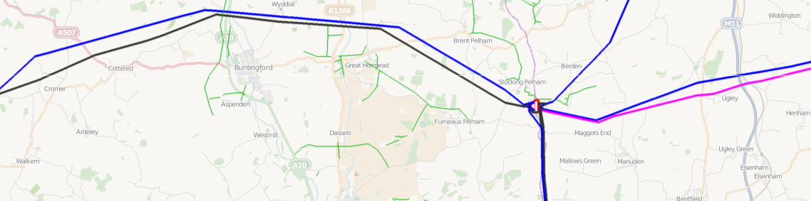
ITO Map Electricity distribution overlay showing 400KV lines (blue), 132KV lines (purple), substations (red) and minor-lines using a thin green stroke.
![]()
Contains map data © OpenStreetMap contributors, made available under the terms of the Creative Commons Attribution-ShareAlike 2.0 (CC-BY-SA-2.0).
File history
Click on a date/time to view the file as it appeared at that time.
| Date/Time | Thumbnail | Dimensions | User | Comment | |
|---|---|---|---|---|---|
| current | 20:51, 3 March 2011 | 1,138 × 283 (212 KB) | PeterIto (talk | contribs) | ITO Map Electricity distribution overlay showing 400KV lines (blue), 132KV lines (purple), substations (red) and minor-lines using a thin green stroke. |
You cannot overwrite this file.
File usage
The following 3 pages use this file: