File:König-Albert-Schacht.png
Jump to navigation
Jump to search

Size of this preview: 800 × 433 pixels. Other resolutions: 320 × 173 pixels | 640 × 347 pixels | 1,047 × 567 pixels.
Original file (1,047 × 567 pixels, file size: 878 KB, MIME type: image/png)
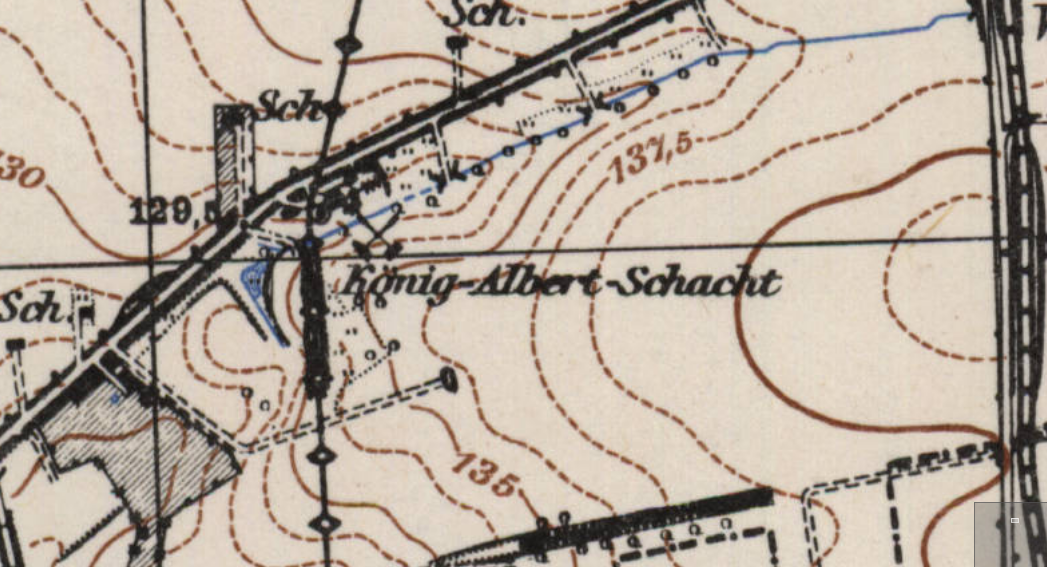
| Description | Der König-Albert-Schacht auf einer Karte von 1932 |
|---|---|
| Author | Reichsamt für Landesaufnahme / Army Map Service |
| Source | https://lib.byu.edu/collections/german-maps/ and https://contentdm.lib.byu.edu/digital/collection/GermanyMaps/id/1536/rec/2 (see https://wiki.openstreetmap.org/w/index.php?title=User_talk:Lutz&curid=93714&diff=2398017&oldid=2397936 ) |
| Date | 1932 / 1952 |
![]()
This file is in a public domain because the copyrightable material in it is so old that the copyright to it is expired.
![]()
.svg)
This work is in the public domain in the United States because it is a work of the United States Federal Government under the terms of Title 17, Chapter 1, Section 105 of the US Code. See Copyright.
Note: This only applies to works of the Federal Government and not to the work of any individual U.S. states, territory, commonwealth, county, municipality, or any other subdivision. This template also does not apply to postage stamp designs published by the United States Postal Service since 1978. (See 206.02(b) of Compendium II: Copyright Office Practices).
Note: This only applies to works of the Federal Government and not to the work of any individual U.S. states, territory, commonwealth, county, municipality, or any other subdivision. This template also does not apply to postage stamp designs published by the United States Postal Service since 1978. (See 206.02(b) of Compendium II: Copyright Office Practices).
File history
Click on a date/time to view the file as it appeared at that time.
| Date/Time | Thumbnail | Dimensions | User | Comment | |
|---|---|---|---|---|---|
| current | 18:42, 19 July 2014 | | 1,047 × 567 (878 KB) | Lutz (talk | contribs) |
You cannot overwrite this file.
File usage
The following page uses this file: