File:Line attachment from aerial imagery.png
Jump to navigation
Jump to search

No higher resolution available.
Line_attachment_from_aerial_imagery.png (329 × 234 pixels, file size: 98 KB, MIME type: image/png)
Summary
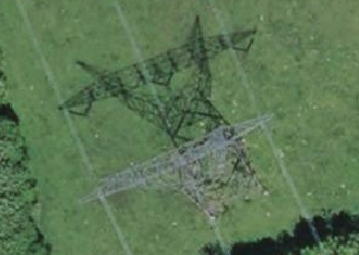
| Description | A suspension power tower as seen from aerial imagery |
|---|---|
| Author | François Lacombe |
| Source | IGN BDOrtho 2023 |
| Date | 2023-04-30 |
Licensing
![]()
![]()
![]()
This work is licensed under the Creative Commons Attribution-ShareAlike 4.0 License.
Attribution: IGN BDOrtho 2023, cropped by François Lacombe
Attribution: IGN BDOrtho 2023, cropped by François Lacombe
File history
Click on a date/time to view the file as it appeared at that time.
| Date/Time | Thumbnail | Dimensions | User | Comment | |
|---|---|---|---|---|---|
| current | 19:16, 30 April 2023 | | 329 × 234 (98 KB) | Fanfouer (talk | contribs) | {{Information | description=A suspension power tower as seen from aerial imagery | source=IGN BDOrtho 2023 | date=2023-04-30 | author=François Lacombe | other_versions= }} |
You cannot overwrite this file.
File usage
The following 2 pages use this file: