File:Major-and-minor-buildings.png
Jump to navigation
Jump to search

Size of this preview: 800 × 556 pixels. Other resolutions: 320 × 222 pixels | 640 × 444 pixels | 1,077 × 748 pixels.
Original file (1,077 × 748 pixels, file size: 398 KB, MIME type: image/png)
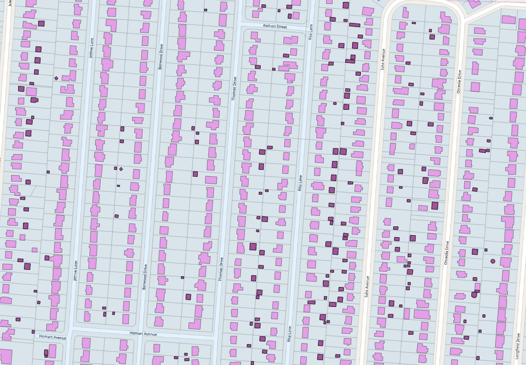
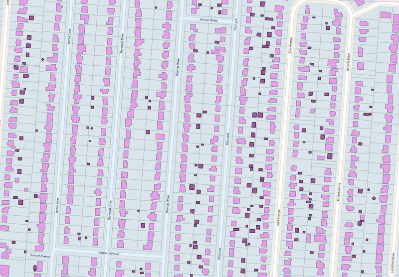
Map showing identification, more or less successful, of major and minor buildings on a parcel (Hamilton County Building import).
File history
Click on a date/time to view the file as it appeared at that time.
| Date/Time | Thumbnail | Dimensions | User | Comment | |
|---|---|---|---|---|---|
| current | 17:36, 31 October 2018 | | 1,077 × 748 (398 KB) | Nate Wessel (talk | contribs) |
You cannot overwrite this file.
File usage
The following 2 pages use this file: