File:Name-left-right-OSM example Adams-Jay County Border Indiana USA.png
Jump to navigation
Jump to search

Size of this preview: 800 × 403 pixels. Other resolutions: 320 × 161 pixels | 640 × 322 pixels | 1,503 × 757 pixels.
Original file (1,503 × 757 pixels, file size: 1.23 MB, MIME type: image/png)
Summary
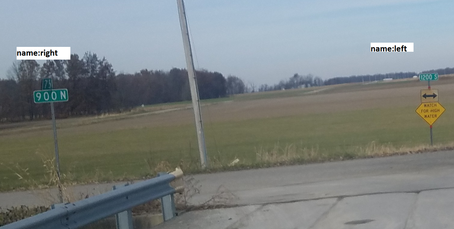
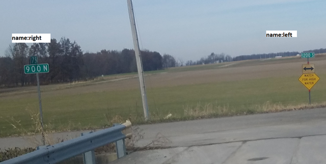
Original image by jbthemilker on Mapillary: https://www.mapillary.com/app/?pKey=457909311938504
Original on Wikimedia Commons: https://commons.wikimedia.org/wiki/File:Indiana_East_1200_South--East_900_North_at_Adams_County_-_Jay_County_border,_United_States.jpg
Annotated version of image uploaded to OSM wiki due to its specific relevance to the project / illustrative purposes (meaning of name:left or name:right could be confusing in other contexts)
Licensing
![]()
![]()
![]()
This work is licensed under the Creative Commons Attribution-ShareAlike 4.0 License.
Attribution: jbthemilker (Mapillary)
Attribution: jbthemilker (Mapillary)
File history
Click on a date/time to view the file as it appeared at that time.
| Date/Time | Thumbnail | Dimensions | User | Comment | |
|---|---|---|---|---|---|
| current | 07:50, 5 May 2022 | | 1,503 × 757 (1.23 MB) | Bgo eiu (talk | contribs) | Original image by jbthemilker on Mapillary: https://www.mapillary.com/app/?pKey=457909311938504 Original on Wikimedia Commons: https://commons.wikimedia.org/wiki/File:Indiana_East_1200_South--East_900_North_at_Adams_County_-_Jay_County_border,_United_States.jpg Annotated version of image uploaded to OSM wiki due to its specific relevance to the project / illustrative purposes (meaning of name:left or name:right could be confusing in other contexts) |
You cannot overwrite this file.
File usage
The following 5 pages use this file: