File:OS OpenData Locator.png
Jump to navigation
Jump to search

Size of this preview: 800 × 514 pixels. Other resolutions: 320 × 206 pixels | 640 × 411 pixels | 819 × 526 pixels.
Original file (819 × 526 pixels, file size: 75 KB, MIME type: image/png)
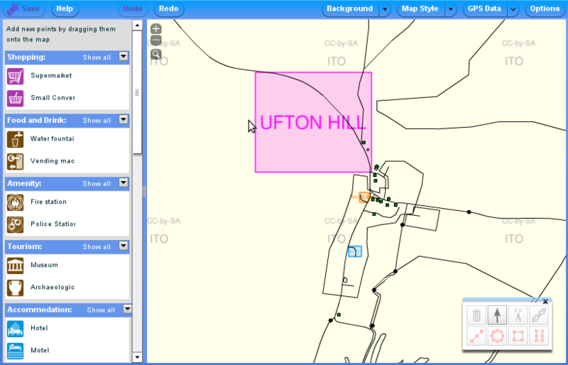
Potlatch2 showing an example of the OS OpenData Locator data as displayed by ITO World. In this example there are 3 roads in Ufton, Warwickshire which either have no name or a different name than OS Locator in the OpenStreetMap database. Please do not assume OS Locator is correct, instead consider surveying the area.
File history
Click on a date/time to view the file as it appeared at that time.
| Date/Time | Thumbnail | Dimensions | User | Comment | |
|---|---|---|---|---|---|
| current | 14:31, 19 April 2012 | | 819 × 526 (75 KB) | RobJN (talk | contribs) | Potlatch2 showing an example of the OS OpenData Locator data as displayed by ITO World. In this example there are 3 roads in Ufton, Warwickshire which either have no name or a different name than OS Locator in the OpenStreetMap database. Please do not ass |
You cannot overwrite this file.
File usage
The following 3 pages use this file: