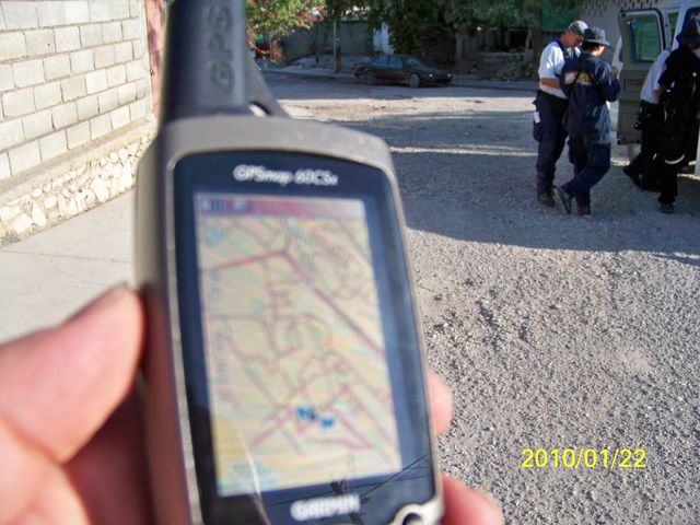
File:OpenStreetMap on a Garmin in Haiti.JPG

Original file (1,000 × 750 pixels, file size: 210 KB, MIME type: image/jpeg)
Photo sent in by Fairfax County Urban Search & Rescue Team who are using OSM garmin downloads in the Haiti Earthquake response
See WikiProject Haiti/Earthquake map resources for details of Garmin downloads
Don't know what license this is released under. It was sent to Harry Wood with the intention of being used as illustration on the OpenStreetMap site, but I think it's safe to assume the photographer (who is pretty busy with other important work right now) will be happy to see it being used in other contexts if you mention Fairfax County Urban Search & Rescue Team and OpenStreetMap.
File history
Click on a date/time to view the file as it appeared at that time.
| Date/Time | Thumbnail | Dimensions | User | Comment | |
|---|---|---|---|---|---|
| current | 12:11, 23 January 2010 | | 1,000 × 750 (210 KB) | Harry Wood (talk | contribs) | Photo sent in by Fairfax County Urban Search & Rescue Team |
You cannot overwrite this file.
File usage
The following 9 pages use this file: