File:Osmcoastline-world.png
Jump to navigation
Jump to search


Size of this preview: 800 × 556 pixels. Other resolutions: 320 × 222 pixels | 640 × 445 pixels | 1,024 × 712 pixels | 1,236 × 859 pixels.
Original file (1,236 × 859 pixels, file size: 273 KB, MIME type: image/png)
This is a Featured image, which means that it has been identified as one of the best examples of OpenStreetMap mapping, or that it provides a useful illustration of the OpenStreetMap project. If you know another image of similar quality, you can nominate it on Featured image proposals.
Front-page image for week 23 of 2012 (4–10 Jun.).
- Image descriptions
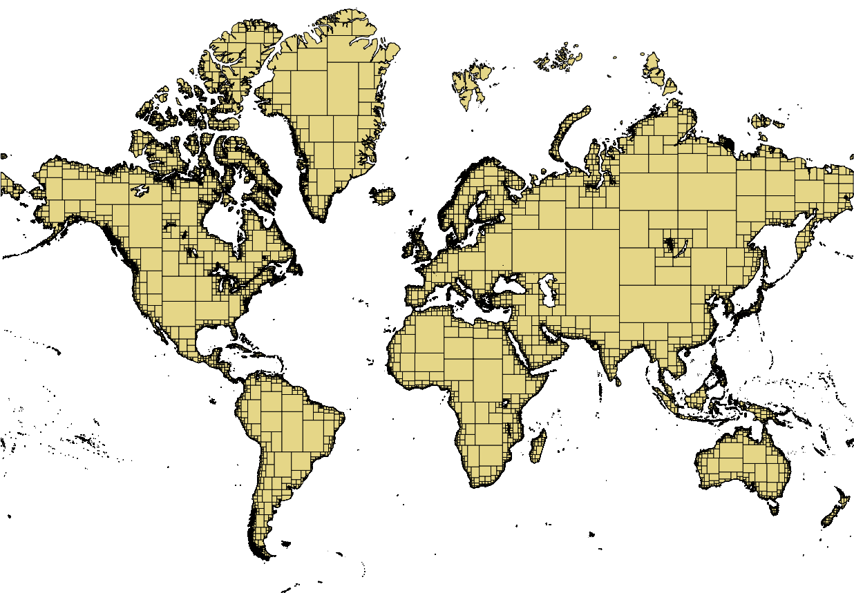
- English : Land polygons created with OSMCoastline from coastlines in OSM. The polygons are split into overlapping smaller polygons to make them easier to handle.
- français : Polygons des terres émergées, crées par OSMCoastline à partir des lignes côtières (coastlines) d'OSM. Les polygones sont découpés en plus petits polygones se chevauchant afin de les rendre plus aisément manipulables.
- italiano : Poligoni delle terre emerse create con OSMCoastline a partire dalle linee di costa presenti in OSM. I poligoni sono suddivisi in ulteriori poligoni sovrapposti più piccoli in modo da gestirli più facilmente.
- 中文(简体) : 用开放街图海岸线资料,以及OSMCoastline软体制作的陆地多边形。为了便于处理,这些多边形已经转成小一点而且重叠的多边形。
- 中文(繁體) : 用開放街圖海岸線資料,以及OSMCoastline軟體製作的陸地多邊形。為了便於處理,這些多邊形已經轉成小一點而且重疊的多邊形。
File history
Click on a date/time to view the file as it appeared at that time.
| Date/Time | Thumbnail | Dimensions | User | Comment | |
|---|---|---|---|---|---|
| current | 15:33, 4 June 2012 | | 1,236 × 859 (273 KB) | Joto (talk | contribs) |
You cannot overwrite this file.