File:PovRay Staufenberg.jpg
Jump to navigation
Jump to search


Size of this preview: 800 × 248 pixels. Other resolutions: 320 × 99 pixels | 640 × 198 pixels | 1,593 × 493 pixels.
Original file (1,593 × 493 pixels, file size: 350 KB, MIME type: image/jpeg)
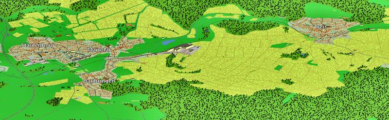
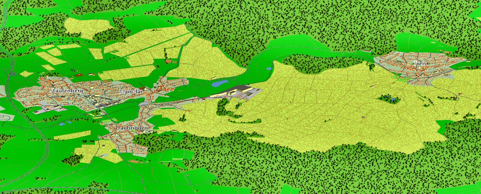
PovRay image generated out of OSM data using the script of Aleš Janda (http://osm.kyblsoft.cz/3dmapa/info).
File history
Click on a date/time to view the file as it appeared at that time.
| Date/Time | Thumbnail | Dimensions | User | Comment | |
|---|---|---|---|---|---|
| current | 16:58, 4 January 2011 | 1,593 × 493 (350 KB) | OliverW (talk | contribs) | Felder Treis korrigiert | |
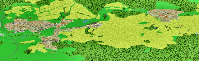
| 12:17, 4 January 2011 | 1,532 × 619 (421 KB) | OliverW (talk | contribs) | Jetzt mit Treis, +Gebäudehöhen | ||
| 20:28, 3 January 2011 |  | 1,150 × 661 (324 KB) | OliverW (talk | contribs) | PovRay image generated out of OSM data using the script of Aleš Janda (http://osm.kyblsoft.cz/3dmapa/info). |
You cannot overwrite this file.
File usage
The following 2 pages use this file: