File:Proposal rendering sac scale via ferrata.svg
Jump to navigation
Jump to search


Size of this PNG preview of this SVG file: 300 × 200 pixels. Other resolutions: 320 × 213 pixels | 640 × 427 pixels | 1,024 × 683 pixels | 1,280 × 853 pixels.
Original file (SVG file, nominally 300 × 200 pixels, file size: 49 KB)
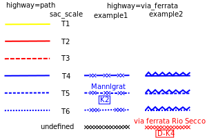
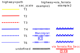
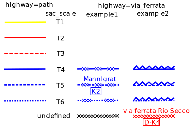
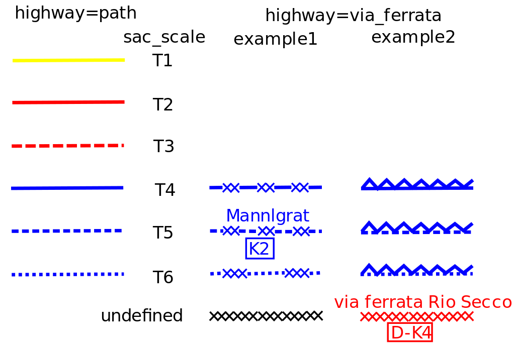
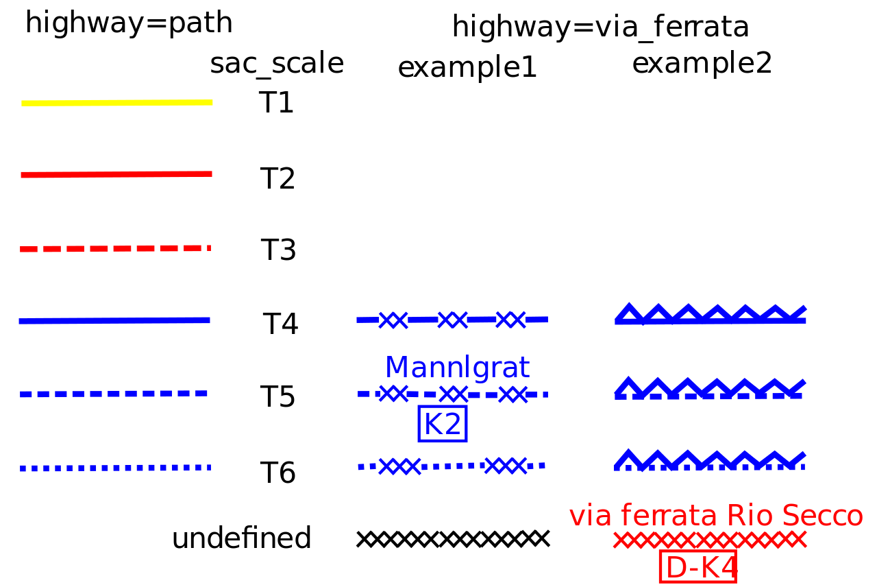
Proposal how rendering of highway=via_ferrata could be on a trekking map
File history
Click on a date/time to view the file as it appeared at that time.
| Date/Time | Thumbnail | Dimensions | User | Comment | |
|---|---|---|---|---|---|
| current | 21:10, 21 January 2011 | | 300 × 200 (49 KB) | Gerchla (talk | contribs) | Proposal how rendering of highway=via_ferrata could be on a trekking map. With 2 examples: different styles and different colours. |
| 20:59, 21 January 2011 |  | 300 × 200 (49 KB) | Gerchla (talk | contribs) | Proposal how rendering of highway=via_ferrata could be on a trekking map | |
| 20:52, 21 January 2011 |  | 300 × 200 (49 KB) | Gerchla (talk | contribs) | Proposal how rendering of highway=via_ferrata could be on a trekking map |
You cannot overwrite this file.
File usage
The following 2 pages use this file: