File:Railway electrification map.png
Jump to navigation
Jump to search

Size of this preview: 800 × 353 pixels. Other resolutions: 320 × 141 pixels | 640 × 282 pixels | 1,204 × 531 pixels.
Original file (1,204 × 531 pixels, file size: 950 KB, MIME type: image/png)
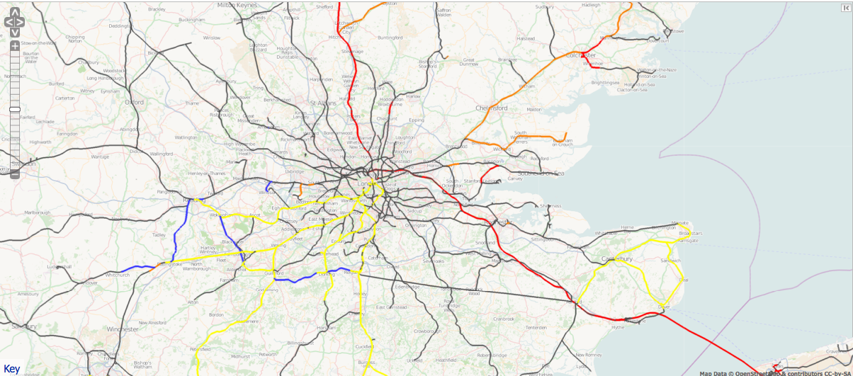
A view from the railway electrification map available on ITO Map. Overhead electrification is shown in red and orange, 3rd rail in yellow. Non-electrified lines are shown in blue and ones of unknown status in grey.
File history
Click on a date/time to view the file as it appeared at that time.
| Date/Time | Thumbnail | Dimensions | User | Comment | |
|---|---|---|---|---|---|
| current | 06:44, 20 May 2011 | | 1,204 × 531 (950 KB) | PeterIto (talk | contribs) | A view from the [http://www.itoworld.com/product/data/ito_map/editor?view=68 railway electrification map] available on ITO Map. |
You cannot overwrite this file.
File usage
The following 4 pages use this file: