File:Rally's typ file.png
Jump to navigation
Jump to search

Size of this preview: 800 × 517 pixels. Other resolutions: 320 × 207 pixels | 640 × 414 pixels | 968 × 626 pixels.
Original file (968 × 626 pixels, file size: 139 KB, MIME type: image/png)
File history
Click on a date/time to view the file as it appeared at that time.
| Date/Time | Thumbnail | Dimensions | User | Comment | |
|---|---|---|---|---|---|
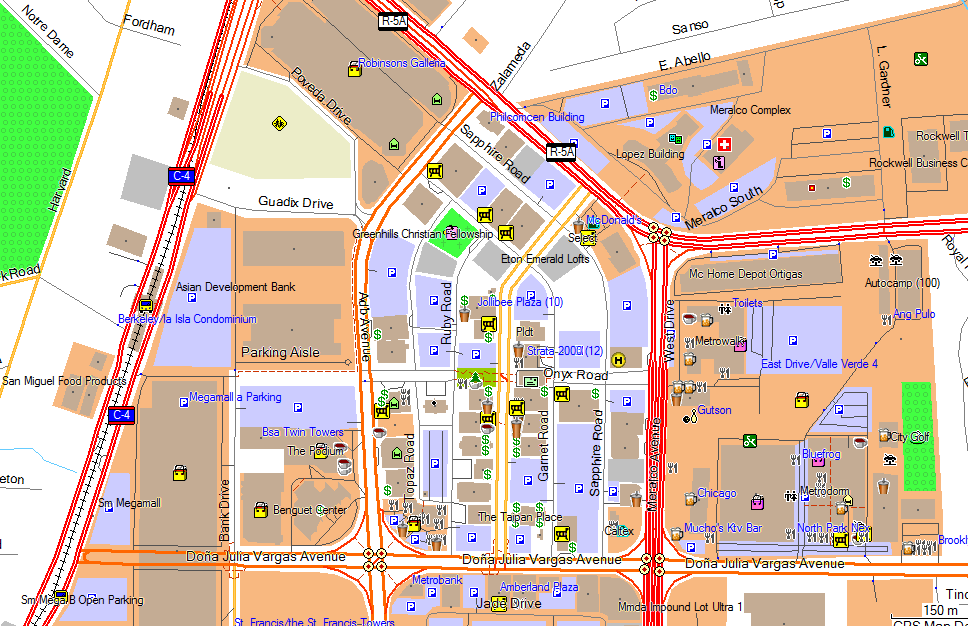
| current | 14:48, 22 November 2010 | | 968 × 626 (139 KB) | Seav (talk | contribs) | ==Information== {{Information |Description = Portions of Ortigas Center as shown using Rally's typ file for Garmin maps. |Source = OSM-PH Garmin map on Garmin MapSource |Author = Screenshot by seav, style by Rally |Date |
You cannot overwrite this file.
File usage
The following page uses this file: