File:Screenshot 2019-12-29 overpass turbo.png
Jump to navigation
Jump to search

Size of this preview: 800 × 449 pixels. Other resolutions: 320 × 180 pixels | 640 × 359 pixels | 1,366 × 767 pixels.
Original file (1,366 × 767 pixels, file size: 377 KB, MIME type: image/png)
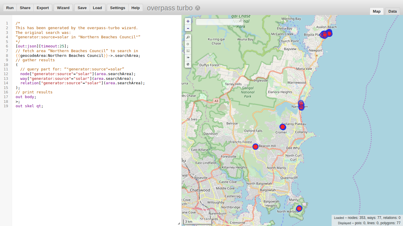
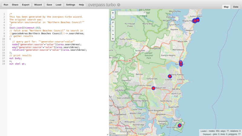
Status of solar power panels mapping on the northern beaches as of 2019-12-29
| Contains map data © OpenStreetMap contributors, made available under the terms of the Open Database License (ODbL).
The ODbL does not require any particular license for maps produced from ODbL data, produced maps may be subject also to other licences. |
File history
Click on a date/time to view the file as it appeared at that time.
| Date/Time | Thumbnail | Dimensions | User | Comment | |
|---|---|---|---|---|---|
| current | 11:26, 29 December 2019 | | 1,366 × 767 (377 KB) | ConsEbt (talk | contribs) |
You cannot overwrite this file.
File usage
The following page uses this file: