Maps4Mac
Jump to navigation
Jump to search
| Maps4Mac | |
|---|---|
| Author: | User:Binary_Alchemy |
| License: | GNU General Public License (free of charge) |
| Platform: | macOS |
| Version: | Beta 2 (2011-03-23) |
| Language: | English |
| Website: | http://code.google.com/p/maps4mac |
| Programming language: | Python |
|
An offline map browser for MacOS | |
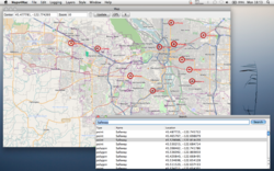
Maps4Mac ([1]) is an offline map display and gps tracking application for MacOS 10.6.
Maps4Mac can render and search OpenStreetMap data stored in a SpatiaLite or PostGIS and includes a GUI for OSM2SpatiaLite to import .osm or .pbf files. It can also render any mapnik XML file, and display GPX or KML files on top of the map.
GPS tracking uses GPSd and logged data can be displayed on the map or exported to a GPX file.
