Proposal:Traffic sign
|
This proposal was built without a vote and the tagging is widely established based on this proposal. The Feature Page for this proposal is located at Key:traffic_sign. |
| Tag:traffic_sign=* | |
|---|---|
| Proposal status: | Inactive (inactive) |
| Proposed by: | Driver2 |
| Tagging: | traffic_sign=* |
| Applies to: | node or way |
| Definition: | Tagging country-specific traffic signs |
| Statistics: |
|
| Rendered as: | traffic sign |
| Draft started: | 2009-04-05 |
| RFC start: | * |
| Vote start: | * |
| Vote end: | * |
Description
This proposal is not necessarily meant to replace anything. The purpose of using this tagging scheme can be:
- Clarify what traffic sign lead to the corresponding Key:access-Tags (in case the given tags could be ambiguous)
- Tag traffic signs that you can't or can't yet tag with other tags
The traffic_sign=*-Tags can either act as a note to other mappers or be parsed automatically in order to use them directly or convert them to other tags.
This should not interfere with the already established traffic_sign=city_limit. You can use whatever values you'd like to, even if they don't follow the guidelines of this proposal, as long as the values don't clash.
Please note that the aim of this proposal is not to replace any access-Tags. It is merely meant as an addition, that may or may not replace other tags in the future.
How to tag
You can use this on nodes, ways or area, whatever the traffic sign applies to. This is not meant to mark the position of the actual sign, instead it goes to the same place as e.g. the access-Tags.
- traffic_sign=<country code>:<one or more combinations of traffic signs>
- <country code> should be the two-letter code of the country the sign belongs to
- combinations of traffic signs are separated by semicolon: ";"
- traffic signs are separated by comma: ","
- traffic signs should be represented by the official id for that particular sign in your country
- where the traffic sign requires a value, you can supply it after the id using brackets: "[value]"
Examples

|
traffic_sign=DE:240 |
 
|
traffic_sign=DE:250,1020-30 |
 
|
traffic_sign=DE:250,1040-30 |

|
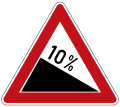
traffic_sign=DE:108[10] |
   
|
traffic_sign=DE:260,1020-31;265[3.8];264[2] |