|
Recording GPS tracks requires a GNSS Receiver (like GPS, Galileo, GLONASS, etc.) with the ability to save your location. Satellite Receiver is a device which allows you to accurately pinpoint your position, by receiving radio signals from satellites. To record tracks and/or waypoints, you will need to select a sat unit with this function — a specialized unit, but also a smartphone are both good candidates.
- If you are hosting a mapping party, you can borrow the GPS units for loan.
أنواع مستقبلات GNSS (أو الساتل)
 A collection of GPS receivers. There are many types of satellite receivers, from a simple logger to smartphones with embedded GNSS chip(s). The most useful for OpenStreetMap listed below.
- GNSS/GPS Loggers
These are typically small devices which are used to record track logs. Although some include a small monochrome LCD screen for displaying basic settings and accuracy measurements, sat Loggers do not provide map displays or navigation features. Some loggers can be connected via USB or Bluetooth to a laptop or phone in order to provide live location data. As they do not have a large display, the battery life can be 24+ hours.
- Hand-held / Sports sat receiver
Hand-held or Sport sat receivers are targeted to the outdoor activities sector. They provide a small colour screen showing a map, and may provide navigation features (e.g. for trekking paths). Generally these are rugged devices that are splash-proof and sometimes waterproof.
- In-car SatNav
With a large colour map display, the main function of In-car SatNav devices is that of navigation. Although some can also record tracks, this is not true of all. Away from a power supply the battery life tends to be quite short (often 3 hours or less).
- Smartphone / Tablet
Many smartphones and tablets include a GNSS chip (or even multiple!). Apps can be installed to provide the ability to record tracks, provide navigation features, and even edit OpenStreetMap directly. Battery life is shortened when the unit is switched on.
- Precise positioning receivers
Certain hardware receivers can emit raw data that can be post-processed to centimeter or decimeter accuracy using post-processing software.
See GPS Reviews for a list of reviews of receivers by OSM contributors.
كيف ترشد
With hundreds of receiver devices available, providing detailed instruction for all of them is infeasible. The following guide therefore provides generic advise to help you get started. Not all the steps may be necessary (or possible) on your particular device. If you need any help, please ask questions on the mailing lists or IRC.
الشروط
- Check if your sat unit has a "Snap to road" or "Lock on road" option, make sure that option is switched OFF, or you will end up merely recording a direct copy of the map loaded into the sat unit, which is not only a copyright infringement (unless your map was downloaded or derived from OpenStreetmap, etc.), but is possibly going to be less accurate than the track you would otherwise record. On Garmin devices, it's on the first page of the map setup.
- Set the position-recording frequency to the highest possible, depending on the memory of your device, the foreseen length of your track, and the speed at which you're travelling. If possible, set it to "every second".
- Mount your sat unit to your vehicle (if applicable and needed). Maybe a simple homemade GPS mount can help.
- If you want to update the OSM map yourself afterward, take what you need to record the details of what you encounter along your track — notepad, voice recorder, digital or video camera, etc. Software such as JOSM will allow you to synchronize your recordings with your path, for example, place the pictures on the map where you took them.
تسجيل المسار
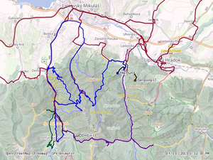 GPS traces of hiking trails recorded during a mapping party in Slovakia ( watch video) Go for a walk or a cycle ride or a drive (or whenever you take any kind of journey)
- Switch your sat unit on at the start of the part of the journey that you want to map
- before you move, wait for a very good fix, i.e., until your connection to satellite has locked as many satellites as possible.
- Clear any track recorded previously, especially if the previous step recorded many false points.
- If necessary, set the sat unit to tracking mode so that it records your journey.
- If you plan to make up the roads later, take notes of the street names and other features, unless you already know them. You cannot later get them from or check them on a map, as this would infringe copyright.
- Record your route along any linear feature — rivers and waterways, footpaths, bridleways, rail and tramways, and any other fixed linear features are of interest to OSM. We want points of interest and area information also, so add this information in your travels where you can.
- If supported by your device, you can record waypoints, too, to mark roundabouts, churches, starts and ends of bridges, etc.
أسئلة مكررة
هل يمكنني استخدام هاتف ذكي؟
It depends. Most smartphones do include GPS receivers and you can record track logs using one of the numerous available apps. Unfortunately the accuracy between phones can vary greatly, even between models from the same manufacturer! It can be very difficult to work out the technical accuracy of a track, but a good compromise is to compare your results to other sources. Have a go at recording a track and check that it is smooth (does not jump all over the place) and is roughly in line with GPS tracks recorded by others (preferred), and/or aerial imagery (least preferred due to inaccuracy of aerial imagery in hilly areas).
Note: Recording GPS tracks on a smartphone will result in the battery running out quicker.
See Software/Mobile for a list of software for your smartphone; for most platforms there is a table comparing the "Track making features" of the apps.
One could also just take photos along the route. You may get the latitude and longitude and the original date time by reading EXIF information from photos you have taken. Generate gpx file(an xml format) either manually of by programming in the proper format for gpx file and test it by opening with JOSM to make sure the gpx file is proper formatted, and then you may be able to load gpx file using web interface or by JOSM upload plugin.
هل يمكنني استخدام SatNav في السيارة؟
Not all car 'SatNavs' include an option to record GPS tracks, and if it does it may be within a hidden service menu. Try searching for your particular model number online or ask in the mailing lists or IRC. Be aware, that even if you can record a track, it may not be practical due to the short battery life (less than 3 hours is common if the screen remains on when recording). Furthermore, some devices have a "lock to track" mode that cannot be disabled and are only useful away from all mapped tracks or roads.
To test this, walk away from a road at 45° and watch if your recorded path follows the road and then suddenly jumps away when you are several 10's of meters away.
ما للتسجيل؟
Anything, as long as it reflects a real world feature. For example, try to avoid tracklogs of flights, as these could be distracting or confusing to other map contributors. Don't worry if you don't have the time to edit the map features after uploading a GPS track - the track on its own is helpful for others. Also tracklogs of roads that have already been mapped are also useful, as they can help to validate the true path of a road by providing more sample points.
وضع علامة على الأشياء التي يتعذر الوصول إليها
إزاحة نظام تحديد المواقع العالمي طريقة
- (تقنية المستوى المتوسط)
When there is a structure or object that you want to GPS but is inaccessible (like a cell tower surrounded by a large fence) then you can use the 'GPS Offset Method' to get its coordinates. To do this you will need your GPS, compass, optionally a range finder and a way to record your data like a notebook or voice recorder. (Instead of using a range finder you can just estimate the distance but this will usually be less accurate.)
- Start collecting GPS points for your waypoint and give it some kind of recognizable ID like CT1 (Cell Tower 1). This is a good opportunity to use the average waypoint feature (that is included in a lot of GPS units) since the next steps will take a minute or so to complete.
- Use your compass to sight the structure and then record the bearing (azimuth) from your current location to the structure in your notebook.
- If you have a range finder, shoot the structure and record the distance to it in your notebook. Estimate the distance if a range finder isn't available.
- End GPS data collection and save your waypoint.
An example format to record this information in your notebook:
- CT1 = 90m @ 340° from WP1
- CT2 = 60m @ 176° from WP2
- etc.
- When you get back to your computer you can download your waypoints and enter your offset notes into a spreadsheet. For less accurate coordinates of these structures, you can use the measure tool included in a lot of mapping programs to measure the distance and bearing. Then place the point referring to your notes about the waypoint offset information.
For highly accurate coordinates of the structure using this offset information, you can use commercial GIS programs like ESRI Arcmap + COGO Extension or Softree Roadeng(Survey). There also exist free utilities to accurately calculate a new coordinate from distance and azimuth, for example Mentor Forward/Inverse or FizzyCalc.
تهدف شرائح مستقيمة طريقة
Another method (much more simple, a little less accurate) is to "draw" two straight segments by GPS traces (walk right towards the object twice from different locations) both pointing at that distant object and then draw two lines through them. The lines will intersect in the object's location.
تقدير
If the unreachable object is not critical, you can simply estimate where it should be on the map, but make sure to mark it with fixme=*, so that others know and possibly position it better later.
انظر أيضا
- دقة بيانات GPS - the accuracy of GNSS data can vary greatly between sat receivers. It is also affected by your surroundings, the weather and the position of satellites at the time of recording the track
- تقنيات رسم الخرائط - other means to get data for mapping, including less complex methods
|


