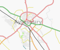
Aylesbury
| V・T・E |
| latitude: 51.8161, longitude: -0.8130 |
| Browse map of Aylesbury 51°48′57.96″ N, 0°48′46.80″ W |
| Edit map |

|
|
External links:
|
| Use this template for your locality |
Aylesbury is a town in Buckinghamshire at latitude 51°48′57.96″ North, longitude 0°48′46.80″ West.
Progress so far
Visited Centre for Buckinghamshire Studies and took A3 copies of the relevent areas from two maps from 1925, which the librarian assured me was out of copyright.
Also visited the County Reference Library and consulted the Postcode Atlas and made notes on the extent of the HP20 postcode. I plan to walk around the the boundary of the postcode, along roads of course, to enclose my mapping effort and allow me to start to be able to estimate how much there is to be done.
Although I'm not expecting any help with this mapping effort people are welcome to join in any way they wish to.
Footsore Finder 15:37 7 June 2006 UTC
I'm wanting to fill out the Buckinghamshire region so I can have a map for the website I run (Aylesbury Vale CAMRA). I'm currently mapping near where I live in Hawkslade.
Silverfish 14:55, 22 March 2007 (UTC)
-- Possible Errors --
I don't believe the train lines are in the correct places. In particular, the line to High Wycombe appears to be further west than it ought. This should be checked out with a GPS sometime.
Silverfish 19:15, 23 March 2007 (UTC)
I'm doing bits of Aylesbury and Wendover. Wendover pretty much done apart apart from the roads in and out. Mostly filled out the town centre from the shell that was there. Working out along the radial roads to cover the suburbs.
Someone else appears to be working the Old Town too, would whoever it is please get in touch since we seem to be trampling on each other's work.
User:ajw 20 April 2007
Well, thats Hawkslade done, bar the foot paths. An hours worth of driving!
Silverfish 06:17, 25 April 2007 (BST)
The suburbs (Quarrendon, Meadowcroft, Watermead, Elmhurst) to the north of the town centre have now had their roads mapped. Not all of the footpaths have been done, only those where the path actually goes somewhere you couldn't reach by road (and possibly not all of those).
User:ajw 12 August 2007