File:Historic USGS Rendering of a Wash.png
Jump to navigation
Jump to search

No higher resolution available.
Historic_USGS_Rendering_of_a_Wash.png (258 × 270 pixels, file size: 96 KB, MIME type: image/png)
![]()
![]()
This file is made available under the Creative Commons CC0 1.0 Universal Public Domain Dedication.
The person who associated a work with this deed has dedicated the work to the public domain by waiving all of his or her rights to the work worldwide under copyright law, including all related and neighboring rights, to the extent allowed by law. You can copy, modify, distribute and perform the work, even for commercial purposes, all without asking permission.
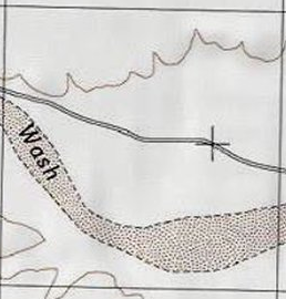
Area of a wash in a USGS topographic map with an area of brown dots with a dashed brown border
File history
Click on a date/time to view the file as it appeared at that time.
| Date/Time | Thumbnail | Dimensions | User | Comment | |
|---|---|---|---|---|---|
| current | 18:25, 24 April 2024 | | 258 × 270 (96 KB) | B1tw153 (talk | contribs) |
You cannot overwrite this file.
File usage
The following page uses this file: