Uploads by Bert Araali
Jump to navigation
Jump to search
This special page shows all uploaded files.
| Date | Name | Thumbnail | Size | Description | Versions |
|---|---|---|---|---|---|
| 15:27, 10 May 2021 | OSMdonation.svg (file) |  |
82 KB | Icon or image to be used related to donations or sponsors. | 1 |
| 02:37, 10 May 2021 | OSMWiki Proposal.svg (file) |  |
6 KB | Button face to reference a proposal page. | 1 |
| 02:36, 10 May 2021 | OSMWiki Project.svg (file) |  |
3 KB | Button face to reference or link to a project page. | 1 |
| 02:34, 10 May 2021 | OSMWiki LocalGuideline.svg (file) |  |
7 KB | Button face to reference or link to a guideline which is locally applicable. | 1 |
| 02:32, 10 May 2021 | OSMWiki GlobalGuideline.svg (file) |  |
10 KB | Button face to link or reference a guiline page which is globally applicable. | 1 |
| 02:29, 10 May 2021 | OSMWiki Categories.svg (file) |  |
3 KB | Button face to reference or link a category or summarization page. | 1 |
| 22:43, 6 May 2021 | OSM UG Guidlelines Workgroup logo.svg (file) | 121 KB | Logo to beused for all activities and pages established by the Ugandan Guidelines & Training Workgroup. | 1 | |
| 21:33, 6 May 2021 | Osmafrica.jpg (file) |  |
22 KB | OSM inspired logog for the OpenStreetMap Africa community | 1 |
| 20:14, 11 February 2021 | Icon OSMdonation user.svg (file) |  |
83 KB | Icon to be used with requests for donations to individual users. License and metadata added to source svg file. | 2 |
| 22:49, 7 February 2021 | Icon validation.svg (file) |  |
11 KB | Icon to indicate sections describing solutions for validation errors and warnings on convention pages. | 1 |
| 22:46, 7 February 2021 | Icon tip trick.svg (file) |  |
13 KB | Icon to be used to mark tip & trick sections on convention pages. | 1 |
| 22:43, 7 February 2021 | Icon tutorial.svg (file) |  |
14 KB | Icon to be used to indicate tutorial or training material on convention pages. | 1 |
| 13:45, 7 February 2021 | Uganda-trafficsign-G22-1.png (file) |  |
15 KB | Ugandan traffic sign. Listed in the UG highway code as G22.1. | 1 |
| 03:53, 7 February 2021 | Icon Micro Mapping.svg (file) |  |
12 KB | Icon to be used to represent the Micro Mapping Strategy. Lighter version. | 2 |
| 03:47, 7 February 2021 | Icon Detailed Mapping.svg (file) |  |
11 KB | Icon to be used to represent the Detailed Mapping Strategy. | 1 |
| 03:46, 7 February 2021 | Icon General Mapping.svg (file) |  |
11 KB | Icon to be used to represent the General Mapping Strategy. | 1 |
| 07:59, 21 January 2021 | Uganda-Zoom 14-Screenshot 2021-01-21 OpenStreetMap.png (file) |  |
554 KB | Uganda shown at zoom level 14. Used as an example for mapping strategies. | 1 |
| 16:19, 19 January 2021 | UG traffic sign R77.1 roundabout directions.png (file) |  |
15 KB | Ugandan traffic sign. Not listed in the UG highway code. Used to show driving directions sharp corners and on roundabouts. Number assigned as subdivision from roundabout R77. | 1 |
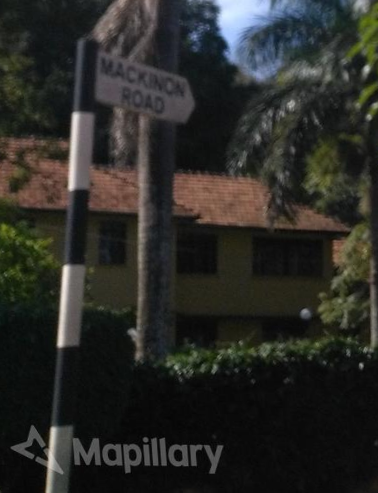
| 23:26, 12 January 2021 | Uganda-Mapillary - Street-level imagery of street name as guidepost.png (file) |  |
355 KB | A street name information sign in Uganda as guidepost. Used to explain tagging and mapping in Uganda. Licensing: “Uganda-Street name as guide post" <https://www.mapillary.com/app/user/ralebipim?focus=photo&pKey=7i8pLjednZCf2eavyPQiMQ&lat=0.31688&lng=32.58555280528053&z=17&x=0.48259954229702146&y=0.6550012137218305&zoom=0> by “ralebipim” <https://www.mapillary.com/app/user/ralebipim?lat=20&lng=0&z=1.5>, licensed under CC-BY-SA. | 1 |
| 22:33, 12 January 2021 | Uganda - Street lamp with advertisement.png (file) |  |
314 KB | Example of a street lamp with attached advertisement in Uganda. The lamp is located on Kintu Road in Kampala and is part of a series of similar lamps along the road. Picture can be used as an example to explain tagging of a location with dual nodes. | 1 |
| 15:21, 27 December 2019 | Osm logo wiki.png (file) | 27 KB | OpenStreetMap Wiki logo | 1 | |
| 14:21, 27 December 2019 | Good Mappers logo GO0MLpt2 400x400.jpg (file) | 21 KB | Logo as used on Twitter of the YouthMappers chapter Good Mappers from Busitema University in Busitema, Uganda. | 1 | |
| 10:13, 6 July 2017 | Mapuganda.png (file) |  |
8 KB | 1 | |
| 21:50, 5 July 2017 | Afritastic 1.svg (file) |  |
20 KB | 1 | |
| 18:48, 5 July 2017 | Uganda-Public billboard-wall.png (file) |  |
260 KB | 1 | |
| 08:31, 5 July 2017 | Uganda-trafficsign-I51.png (file) |  |
16 KB | 1 |