2016 Ecuador earthquake
| General Information | |
|
The strongest earthquake to hit Ecuador in decades flattened buildings and buckled highways along its Pacific coast, sending the Andean nation into a state of emergency. As rescue workers rushed in, officials said Sunday at least 233 people were killed, over 588 injured and the damage stretched for hundreds of miles to the capital and other major cities. The magnitude-7.8 quake, the strongest to hit Ecuador since 1979, was centred on Ecuador's sparsely populated fishing ports and tourist beaches, 170 kilometres (105 miles) northwest of Quito, the capital. Please see more information regarding the situation from this article. What We Do Who Can Use Our Maps? The Response Coordination
Donate Donate to the OpenStreetMap Foundation The Humanitarian OpenStreetMap Team also need your donations, to help funding humanitarian mapping projects and development/maintenance of systems such as the Tasking Manager. | |
For Aid Organizations
Map and Data Services
About OpenStreetMap
OpenStreetMap offers an online map (and spatial database) which is updated by the minute. Various tools and services allow data extracts for GIS specialists, Routable Garmin GPS data, Smartphone GPS navigation, and other device-compatible downloads. With an internet connection, regular syncing is possible with open access to the community contributed data as it comes in, with OpenStreetMap's bulk data downloads ideal for use offline. In addition, maps can also be printed to paper.
Browse the Activation Area to get a feel for the data that is currently available. Different map styles, including a special Humanitarian style, can be selected on the right side of the screen. Though some data may not render (appear) on the online map, it can be exported from the underlying database for other uses requiring more detail.
About HOT
The Humanitarian OpenStreetMap Team (HOT) is a global community of mostly volunteers, but we are also a US non-profit able to contract with organizations and a 501-c-3 charitable organization. To learn more about the HOT, explore more of our wiki pages and our website hotosm.org. Please get in touch with us at info@hotosm.org.
Printing Paper Maps
Large poster-size maps and letter-size paper atlases of custom areas can be printed:
- FieldPapers with grid for field survey or general navigation purposes,
- MapOSMatic with grid, street index and POI, good for command centers, hospitals, etc.
Exporting OpenStreetMap Data
There are numerous ways to export OpenStreetMap data as listed below:
- HOT Export Tool is the easiest way to get OpenStreetMap data exported into various file formats. Please see the instructions created by Ramani Huria on how to do so.
- A pre-generated export is already available here. Just click on the desired file format at the bottom-right of the page to download.
- Downloading Data wiki page provides instructions on how to export large scale map data with the use of other tools.
- Other data extract provided by OpenStreetMap.fr and GFDRR can be found here.
Online Disaster Routing (SOS ORS)
- OpenRouteService | Ecuador
- Disaster OpenRouteService for Ecuador Earthquake
- Tagging Scheme for blocked roads: status=impassable or impassable=yes ( compare e.g. HOT task job 1831 )
Offline navigation data proves to be very useful to the humanitarians deployed in foreign countries. And there are a number of tools available on Android and iOS that are easy to use and highly effective:
About This Disaster Mapping Response
Coordination
- Humberto Yances UTC-05:00
- General inquiries can be made to the HOT Activation Working Group | activation@hotosm.org
- OSM partners with governmental organizations, DHNetwork partners, UN agencies, international humanitarian organizations and providers of satellite imagery.
Support Team
Tyler Radford, Mikel Maron, Dale Kunce, Fred Moine and Mhairi O'Hara are supporting this Activation.
Response Timeline

- ... response continues under local leadership ...
- 2nd May - 2300 mappers have made close to 3 million changes to OpenStreetMap with most Tasking Manager projects through the first round. Expert mappers are now needed to validate the post-event projects.
- 28 April - Over 2200 mappers have made 2.5 Million+ changes to OpenStreetMap using #MappingEcuador changeset comment.
- 24 April - Over two million changes made using #MappingEcuador changeset comment.
- 21 April - Over one thousand OSM contributors making more than a million changes to the map in response to the Ecuador earthquake.
- 18 April - Imagery Coordination becomes high priority, various providers begin releasing imagery of both pre and post event, coordinators begin releasing projects for areas previously covered in cloud or low-resolution in the default imagery sources (projects continue to be focused on pre-event status).
- 17 April - First Mapping Projects released with guidance of OSM Ecuador community members. Initial HOT Size-up as Moderate Event with Local Leadership - HOT defers standing-up team to continue support for this response as well as to Japan earthquakes on 14th and 15th.
- 17 April 00:39UTC - HOT Voting Member and Activation Working Group Volunteer, Humberto Yances alerted the group via email of the earthquake and would be monitoring.
Status Updates
- HOT Update 19th April
- Ecuador Earthquake Special Regional Report No.1 18-19th April 2016
- Humanity Road 17th April 2016
- Ecuador Earthquake Sitrep No. 1 17th April 2016
For Mappers
How You Can Contribute
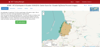
- The HOT Tasking Manager coordinates emergency mapping by volunteers. This is the first stop for emergency mappers. If you are a beginner and want to contribute, we suggest that you visit the Tasking Manager Tutorial at LearnOSM.
- The HOT email list provides communication with the contributors. All HOT mappers are encouraged to join this list.
- The Live #hot HOT IRC Channel provides discussions with the Support Team. To join, create a nickname and type at the bottom of the screen to talk to other
- You can contribute from the internet by tracing buildings, roads, waterways, etc. To react rapidly to support humanitarians deploying, we need a lot of contributors for remote editing.
- There are a number of great online tools that will guide you on how to sign up to OpenStreetMap and start mapping with the Tasking Manager. Please see the list of great sites listed in the next section.
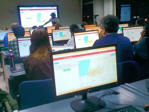
- The best way to learn is to participate to Mapathons where experience contributors of your community will show you the basics of editing. There are a list of events related to this activation listed below.
Learn to Map
- Ecuador Mapping Guide
- Most of our volunteer needs are for remote OSM contributors, visit LearnOSM.org to get started.
- If step by step videos work better for you these MapGive Learn to Map Videos will get you from zero to mapping fast.
- The Missing Maps project also has some great guidance on their Contribute page. There are great videos demonstrating how to open up a OSM account, start mapping and using the Tasking Manager.
Mapping Priority
- Please choose from highest priority first.
Validation
- Experienced mappers are also asked to participate in validating completed tasks.
- Information on validating can be found here.
- More experienced OSM contributors are invited to revise the classification of roads.
- You also can assure the quality of the mapping by validating the Task manager tasks or using the various OSM Quality control tools.
Tasking Manager Projects
| Job No. | Priority | Location | What to map | Imagery to Use | Task Mapping Status | Task Validation Status | |
|---|---|---|---|---|---|---|---|
| TASKS FOR ALL CONTRIBUTORS - HIGH | VALIDATION BY EXPERIENCED CONTRIBUTORS ONLY | ||||||
| Project 1882 | High | Surrounding the areas of Cantón Tosagua | Detailed mapping | SigTierras | In Progress (76%) | In Progress (1%) | |
| Project 1842 | High | Surrounding the areas of Cantón Chone | Detailed mapping | SigTierras | In Progress (98%) | In Progress (19%) | |
| TASKS FOR EXPERIENCED CONTRIBUTORS - URGENT | VALIDATION BY EXPERIENCED CONTRIBUTORS ONLY | ||||||
| COMPLETE/ARCHIVED | |||||||
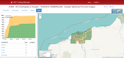
| Project 1836 | High | Surrounding the areas of Esmeraldas | Detailed mapping | SigTierras | In Progress (99%) | In Progress (99%) | |
| Project 1840 | High | Surrounding the areas of Sucre Sur | Detailed mapping | SigTierras | In Progress (97%) | In Progress (51%) | |
| Project 1846 | High | Surrounding the areas of Cantón Atacames | Detailed mapping | SigTierras | In Progress (97%) | In Progress (21%) | |
| Project 1843 | High | Surrounding the areas of Cantón Rocafuerte | Detailed mapping | SigTierras | In Progress (99%) | In Progress (99%) | |
| Project 1841 | Archived | Surrounding the areas of Sucre Norte | Detailed mapping | SigTierras | In Progress (99%) | In Progress (98%) | |
| Project 1839 | Archived | Surrounding the areas of Jama | Detailed mapping | SigTierras | Complete (100%) | In Progress (31%) | |
| Project 1838 | Archived | Surrounding the areas of San Vicente | Detailed mapping | SigTierras | In Progress (99%) | In Progress (51%) | |
| Project 1833 | Archived | Surrounding the areas of El Rosario | Detailed mapping | IGM | Complete (100%) | In Progress (33%) | |
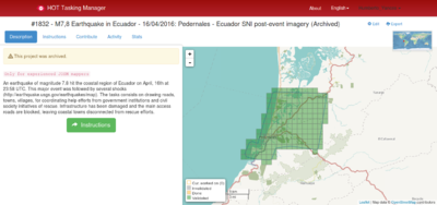
| Project 1832 | Archived | Surrounding the areas of Puertoviejo | Road Network - Post-event Imagery | SNI | Complete (100%) | Complete (100%) | |
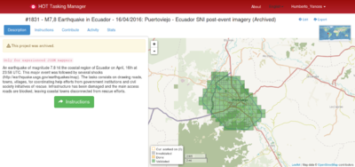
| Project 1831 | Archived | Surrounding the areas of Puertoviejo | Road Network - Post-event Imagery | SNI | Complete (100%) | Complete (100%) | |
| Project 1805 | Archived | Surrounding the areas of Muisne | Detailed mapping | IGM | In Progress (97%) | In Progress (96%) | |
| Project 1797 | Archived | Surrounding the areas of Pedernales Canton | Detailed mapping | IGM | In Progress (99%) | In Progress (29%) | |
| Project 1796 | Archived | Surrounding the areas of Portoviejo Canton | Detailed mapping | Default | In Progress (99%) | In Progress (89%) | |
| Project 1795 | Archived | Surrounding the areas of Manta, Montecristi and Jaramijo | Detailed mapping | Default | Complete(100%) | In Progress (97%) | |
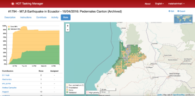
| Project 1794 | Archived | Surrounding the greater areas Pedernales Canton | First pass for detailed mapping | Default | In Progress (89%) | In Progress (89%) | |
General Map Improvements
As well as small square shaped contributions, we can look to make more wide ranging improvements. Reviewing/improving the overall map data consistency is very useful, but that is also most prone to edit conflicts so please save often and understand in the busy time like this you might encounter edit conflicts.
Local Knowledge
Local knowledge is essential to the accuracy of OpenStreetMap data by adding the names of roads or various infrastructure items. Any details of infrastructure, buildings or road names that you know and can positively identify are extremely helpful to responding organizations.
You even can edit the map using small mobile devices, and applications with offline mapping. Add a Note or report an Error using the Notes feature on the Online Map which lets you drop a marker and attach a note with information about the location/building/road and OSM contributors will edit the map from your comments.
For simple instructions on how to share your knowledge with our mappers please see the quick How to easily share local knowledge with OSM Notes guide.
Available Imagery
Imagery Availability is not consistent in the impacted area, please refer to individual project instructions on the Tasking Manager.
OSM Default Imagery Sources
The imagery in the impacted area is variable; Bing hi-res is cloudy or missing for parts of the impacted area; it will be necessary to switch between Bing and Mapbox, and there are also complete gaps of default imagery coverage.
Bing
Bing provides a global imagery data source that is the 'default' Imagery available for OSM (default option in most editors).
Mapbox
Mapbox provides an additional imagery source and should be compared to Bing (use Bing for alignment if available and not instructed otherwise)
Alternative Imagery Sources
How to add/use Alternative Imagery
In many cases better imagery is available than the default; when possible we set up a remote link directly via the Tasking Manager, so there is nothing to do, the iD editor and (as long as enabled) JOSM will automatically add the imagery.
Additionally, with JOSM, it's relatively easy to add special imagery if the license is appropriate for tracing into OSM. For more details see JOSM Imagery Help
DigitalGlobe
DigitalGlobe has kindly opened access to their imagery for disaster response. Post event satellite imagery is available for download with a CC0 license, more information on the blog: http://www.digitalglobeblog.com/2016/04/19/open-imagery-and-data-to-support-ecuador-earthquake-response/.
Other Data
| Information | Formats | Source | Authorization/License | URL | Observation |
|---|---|---|---|---|---|
| Affected cantons | shp | SENPLADES | Direct shipping for mapping | https://drive.google.com/folderview?id=0Bx60Wr7TwLBHQzA0UktPTlRWeVk&usp=sharing | V4: Cantons most affected 2016/04/17 |
| Base information (centros educativos, de salud, vías, etc) | shp | SNI | Verbal authorisation from the Ministra Sandra Naranjo a Daniel Orellana (2016/04/17) | http://sni.gob.ec/coberturas | The Instituto Geográfico Militar (IGM) provided images or WFS, perhaps should make direct import? |
| Ortophotos IGM | wms | IGM | Verbal authorisation from the director of IGM a través de Fernanda León a Daniel Orellana (2016/04/17) | http://www.geoportaligm.gob.ec/orto/wms?service=wms&version=1.3.0&request=GetCapabilities / TMS para JOSM: http://imagery.openstreetmap.fr/tms/1.0.0/ecuador_orto/{zoom}/{x}/{y} | |
| Orthophotos SIGTIERRAS | wms | SIGTIERRAS | Verbal authorisation from Leonardo Espinoza undersecretary of information SENPLADES Daniel Orellana (2016/04/17) | http://geoportal.sigtierras.gob.ec:8080/geoserver/ows?SERVICE=WMS | Does not cover the affected area |
| Universities: Offices and Extensions | shapefile | SENESCYT | Verbal authorisation from Alexandra Escobar SENESCYT | https://drive.google.com/folderview?id=0Bx60Wr7TwLBHMWlGNnRkVy03NW8&usp=sharing | |
| Adminstrative Division | Shapefile | SNI | Verbal authorisation from Ministra Sandra Naranjo a Daniel Orellana (2016/04/17) | https://drive.google.com/open?id=0Bx60Wr7TwLBHeE0zbVJEOGRSaGM | |
| Helipads, Lakes, Medical, Schools and other potentially useful datasets | GeoJson, Shapefile, KML, SQL and PBF formats. | OpenStreetMap.fr | Data extracts provided by OpenStreetMap.fr and GFDRR | http://ecuador.piensa.co | Daily exports for OSM data in Ecuador based on Geofabrik's country PBF file |
| Images 2014 | wms | IGM | WMS from the Instituto Geográfico Militar (IGM) of Ecuador | http://www.geoportaligm.gob.ec/orto/wms?service=wms&version=1.3.0&request=GetCapabilities
Imágenes seleccionadas : http://imagery.openstreetmap.fr/tms/1.0.0/ecuador_orto/{zoom}/{x}/{y} Grid coverage images (which appear to be 2014) : http://imagery.openstreetmap.fr/tms/1.0.0/ecuador_orto_grid/{zoom}/{x}/{y} Other images from 2014 : http://imagery.openstreetmap.fr/tms/1.0.0/ecuador_orto_2014/{zoom}/{x}/{y} |
Each image can be accessed individually in WMS (in JOSM) |
| Images 2015 | wms | IGM | WMS from the Instituto Geográfico Militar (IGM) of Ecuador | http://www.geoportaligm.gob.ec/orto/wms?service=wms&version=1.3.0&request=GetCapabilities
Images 2015 : http://imagery.openstreetmap.fr/tms/1.0.0/ecuador_orto_2015/{zoom}/{x}/{y} A layer with all these (sometimes hiding) : http://imagery.openstreetmap.fr/tms/1.0.0/ecuador_orto_todo/{zoom}/{x}/{y} |
Each image can be accessed individually in WMS (in JOSM) |
Mapping Events
Mapathons
| Country | City | Place | Date and Time | Contact | More Information |
|---|---|---|---|---|---|
| Nepal | Kathmandu | Kathmandu Living Labs | 17 April - ongoing | KLL | NN |
| Nepal | Pokhara | Kathmandu Living Labs | 21 April | KLL - PreparePokhara | NN |
| Ecuador | Cuenca | LlactaLab | 20 April | Hangout | NN |
| Italy | Como | Politecnico Milano | 20 April | Mapathon | http://geolab.como.polimi.it/?page_id=2150 |
| Spain | Barcelona | Telecentre de Llefià | 21 April | Mapathon | http://llefia.org/index.php?option=com_content&view=article&id=225:mapes-per-ajudar-a-lequador |
| USA | Broomfield, CO | Nighthawk Brewing | 21 April 2300UTC | OSM-Colorado | |
| USA | New York, NY | CartoDB Office | 21 April 1730 UTC-5 | Register Here | |
| Croatia | Cestica | Hiperaktivni | 22 April 2000 UTC+01 | https://twitter.com/burgerGIS/status/723414152530653185 | |
| Spain | Barcelona | FIB - UPC | 22 April | Mapathon | http://inlab.fib.upc.edu/ca/blog/ajuda-millorar-la-cartografia-de-lequador |
| Ecuador | Quito | Escuela Politécnica Nacional | 22 April | NN | NN |
| Ecuador | Quito | CIESPAL | 22 April | http://www.medialabuio.org/actividades-medialab/taller-de-colaboracion-con-mappingecuador-para-usar-openstreetmap-y-mapear-las-zonas-de-desastre-en-ecuador/ | NN |
| Spain | l'Hospitalet de Llobregat | Centro Cultural La Bòbila | 23 April | Mapathon | NN |
| USA | Seattle | Douglass-Thruth Library | 23 April | http://www.meetup.com/es-ES/OpenStreetMap-Seattle/events/230031437/?eventId=230031437&chapter_analytics_code=UA-73699428-1 | NN |
| Spain | Valencia | Universidad de Valencia | 25 April | Comunitat Valenciana HOT Ecuador Mapathon 2 | NN |
| Spain | Alicante | Universitat d'Alacant | 25 April | Comunitat Valenciana HOT Ecuador Mapathon 2 | NN |
| Spain | Ontiyet | Sede del Consejo de la Juventud | 25 April | Comunitat Valenciana HOT Ecuador Mapathon 2 | NN |
| Ecuador | Quito | FLACSO | 26 April | https://www.flacso.edu.ec/portal/contenido/eventos/mapathon-flacso.1582 | NN |
| USA | Seattle | University of Washington | 27 April | OSM Seattle Ecuador Mapathon | |
| USA | Lubbock | Texas Tech Youth Mappers | 29 April | https://www.facebook.com/youthmapperstexastech | http://www.youthmappers.org/#!chapters/fodoy |
News and other resources
- Mapping Ecuador's post-earthquake landscape Australian Broadcasting Corporation - ABC
- Datos ejemplares a nivel global: #MappingEcuador School of data
- El software libre y su 'granito de arena' en los desastres naturales: El Telégrafo
- #MappingEcuador traza la ruta de ayuda: Diario Expreso
- Creating a Map to Navigate the Post-Earthquake Landscape in Ecuador: The New Yorker
- Un Mapa para Entregar Ayuda: ElTiempo
- Mapeo humanitario: cómo ayudar al Ecuador después del terremoto: Abierto Al Público - Blog del Banco Interamericano de Desarrollo - BID
- Cómo Ayudar a Ecuador después del Terremoto: El País
- Así Ayudan a Salvar Vidas los Anónimos de Internet: El Mundo
- Recursos para Mapeo Abierto por Ecuador: Escuela de Datos
Associated hashtags
- #EcuadorEarthquake
- #TerremotoEcuador
- #PrayForEcuador
- #MappingEcuador
- #Ecuador

