Featured images/Apr-Jun 2019
Jump to navigation
Jump to search


These are featured images, which have been identified as the best examples of OpenStreetMap mapping, or as useful illustrations of the OpenStreetMap project.
If you know another image of similar quality, you can nominate it on Featured image proposals.
| ← from April to June 2018 | ← from January to March 2019 | from July to September 2019 → | from April to June 2020 → |
Gallery of featured images, from April to June 2019
2019, week 14
2019, week 15

2019, week 16

2019, week 17

2019, week 18
2019, week 19

2019, week 20
2019, week 21
2019, week 22
2019, week 23
2019, week 24
2019, week 25
2019, week 26
Details and captions
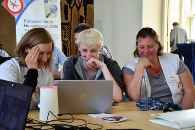
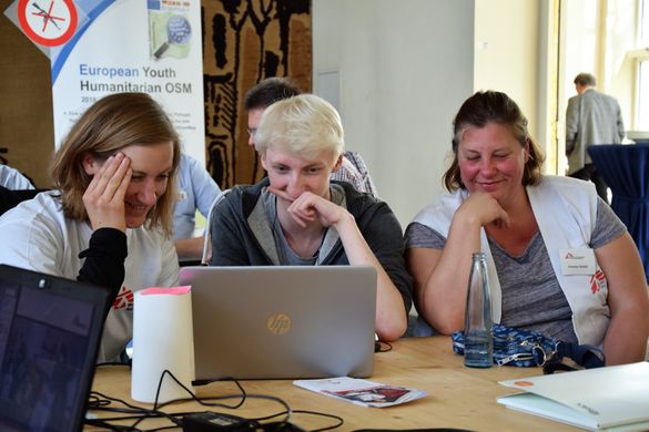
Week 14 (from Monday 1 April 2019 to Sunday 7 April 2019) [Edit]

- English : European Youth Humanitarian OSM Erasmus+ Students EuYoutH OSM from Portugal, Spain, Romania, Germany and Ireland during a Mapathon in Portmarnock Community School, mapping Lesotho and Mozambique.
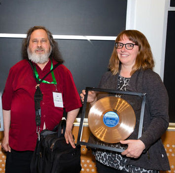
Week 15 (from Monday 8 April 2019 to Sunday 14 April 2019) [Edit]

- English : Kate Chapman, holding the Free Software Foundation 2018 award for projects of social benefit, together with FSF founder and president Richard Stallman, who presented the award during LibrePlanet 2019.
Week 16 (from Monday 15 April 2019 to Sunday 21 April 2019) [Edit]

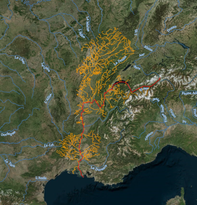
- English : riverbasinmap.com - An interactive world map of rivers and river basins, showing the Rhone. [1]
Week 17 (from Monday 22 April 2019 to Sunday 28 April 2019) [Edit]

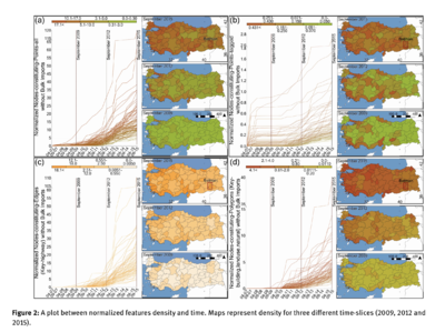
- English : Growth of OpenStreetMap data density in Turkey, presented in a paper of various time series spatial analyses
Week 18 (from Monday 29 April 2019 to Sunday 5 May 2019) [Edit]

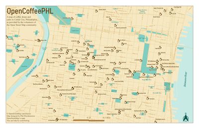
- English : OpenCoffeePHL, a map of coffee shops and cafes in Center City, Phladelphia
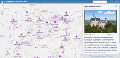
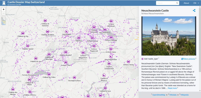
Week 19 (from Monday 6 May 2019 to Sunday 12 May 2019) [Edit]

- English : The Castle Dossier Map is currently the most complete web map of castles and palaces in Switzerland, including nearby countries (Germany, France, Italy and Liechtenstein) - right up to Neuschwanstein Castle. The multilingual web application mashes OpenStreetMap with Wikidata, Wikimedia Commons (images) and Wikipedia.
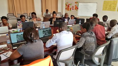
Week 20 (from Monday 13 May 2019 to Sunday 19 May 2019) [Edit]

- English : Hans van der Kwast organised a mapathon at WARMA Zambia, helping them learn OpenStreetMap while mapping Zambia for disaster preparedness and water/sanitation provision (HOT Task)
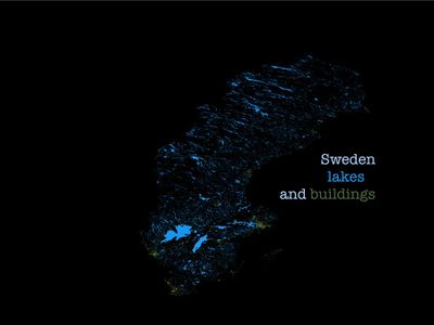
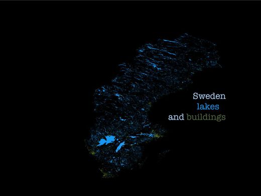
Week 21 (from Monday 20 May 2019 to Sunday 26 May 2019) [Edit]

- English : Sweden Lakes and Buildings - A simple but stylish rendering in QGIS
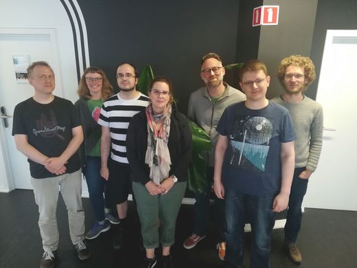
Week 22 (from Monday 27 May 2019 to Sunday 2 June 2019) [Edit]

- English : The OpenStreetMap Foundation Board. From left to right: Frederik Ramm, Kate Chapman, Paul Norman, Heather Leson, Mikel Maron, Tobias Knerr and Joost Schouppe, having a face-to-face meeting recently
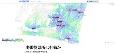
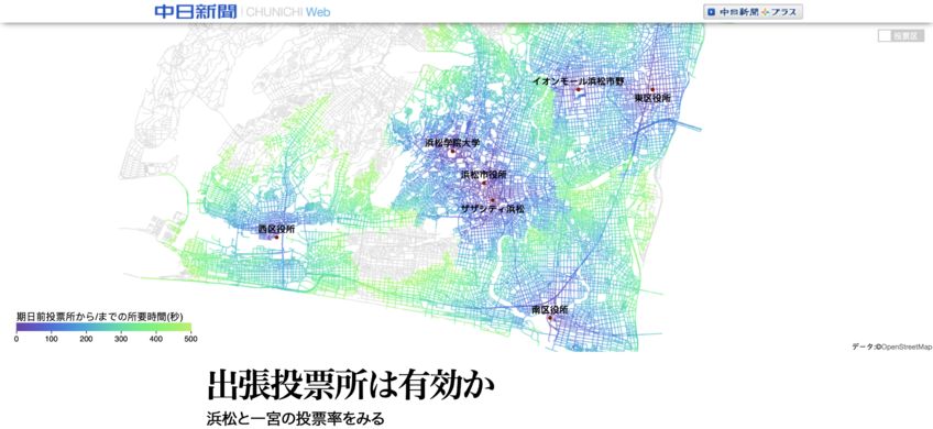
Week 23 (from Monday 3 June 2019 to Sunday 9 June 2019) [Edit]

- English : Map of voting station travel times appearing on this chunichi.co.jp article (ja), analysing whether turnout improved with provision of more voting stations in Hamamatsu and Ichinomiya, Japan.
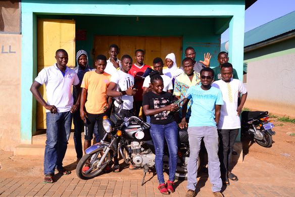
Week 24 (from Monday 10 June 2019 to Sunday 16 June 2019) [Edit]

- English : The Legendary club of Larabanga, Leclara, is introducing community-run, sustainable tourism initiatives in Ghana with the help of a HOT microgrant
Week 25 (from Monday 17 June 2019 to Sunday 23 June 2019) [Edit]
- English : The Legendary club of Larabanga, Leclara, is introducing community-run, sustainable tourism initiatives in Ghana with the help of a HOT microgrant
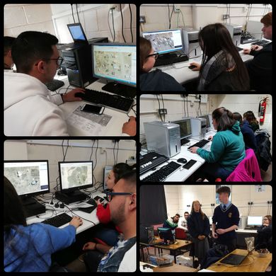
Week 26 (from Monday 24 June 2019 to Sunday 30 June 2019) [Edit]

- English : At the Libre Graphics Meeting in Saarbrücken, OpenSaar e.V. organised the first mapathon in Saarland together with Doctors Without Borders. Students of the Erasmus+ project EuYoutH OSM helped newcomers to map with JOSM.